Tag: maps

Book review: Hidden Histories by Mary-Ann Ochota

For my next book I read hidden-historiesHidden Histories: A spotter’s guide to the British Landscape by Mary-Ann Ochota. As a countryside walker and cyclists of many years, I’ve always been interested in what I saw and how it came to be, Hidden Histories is just the book for me.
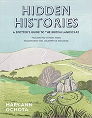
The book is divided into broad sections: lumps and bumps, stones, lines and "in the village" and within each of these sections there are 10 or so topics covered over a few pages each. There are many illustrations, and photographs on pretty much every page. Domestic buildings and churches are covered but castles and stately homes are not which is not unreasonable.

If there is a gap it is in the coverage of industrial landscapes which is limited, this reflects my interests and where I have lived, and holidayed, as much as anything.

"Lumps and bumps" covers long barrows (collective burials dating back to the Neolithic), round barrows (single burials, found in nearly every parish dating back to the Bronze Age), hillforts (defensive earthworks from the Iron Age), miscellaneous earthworks and the ridge-and-furrow plough system. I was interested to learn that windmill bases can be mistaken for round barrows. One learning of this section is that there are only known burials for about 10% of the estimated population of prehistoric Britain. I grew up in Dorset which makes frequent appearances in this part of the book. Maiden Castle was a regular walking spot – it is the biggest Iron Age hillfort in Europe.

The ridge-and-furrow plough systems makes a re-appearance in the section on lines. Essentially visible ridge-and-furrow systems are usually at least seven centuries old and are the result of the medieval method of farming with ox-drawn ploughs which leave a shallow S-shaped furrow. This gentle S-shape is also seen in ancient field boundaries. The way land was owned and shared is also relevant, in medieval times land was common with patches exploited by individuals but individual plots did not have hedge boundaries. This ended with the Enclosures Acts in the 18th and 19th century that made land ownership more individual although in principle it shared land equitably in practice it favoured the rich who had the resources to exploit land in line with the new Acts. Enclosure Acts were particularly important in the Midlands and had widespread impacts on both people and the landscape.

"Stones" covers standing stones, stones in circles,stones in lines, stones with symbols on them, stone crosses, stone tools and wayside markers (stone ones!). Standing stones are difficult to date, and Stonehenge is pretty unique in that its constituent parts are not local, usually stone circles are built from local stone.

"Lines" talks about Roman roads, and other ancient pathways before moving on to the shapes of fields and various chalk figures. I grew up just down the road from the impressive Cerne Abbas giant which is 2000 years old, there is also a white horse on the hillside into Weymouth but that is of George III and dates back to 1808. I hadn’t appreciated that chalk figures require very regular maintenance which is impressive considering the Uffington white horse dates back to 1400BC.

Holloways have a number of mentions – these are ancient routes that have been worn below the prevailing ground level by use. It is chastening that after the Romans left their road building skills were not surpassed until the turnpike roads were introduced a thousand years later.

"In the village" covers various buildings found in villages, mainly houses and churches but briefly mentioning pubs and barns. The age of homes is of direct professional interest for me, although the focus of Hidden Histories is older buildings. I was bemused to learn that the term "Gothic" was originally applied as an insult coined in the 1600s to describe what they saw as overly ornate buildings from the 1200-1500s.

I learnt a wide range of useful facts from this book, such as "metalled" roads being derived from the Latin for "quarry" which has always puzzled me! I also learnt that "turbary" refers to peat workings, so I have learnt a new word to slip into conversation.

I’m interested in maps and computers so it struck me there are some interesting things to do in geospatial analysis relating to this book. For example, medieval ridge-and-furrow ploughing shows up quite nicely in LIDAR, as do other earthworks. Similarly field boundaries and place names, and other mapping features, are all in Ordnance Survey mapping products and these days are readily accessible by automated means.

Cheshire, where I live now, has few entries although on this morning’s cycle I was spotting what I now know to be Enclosure Act hedging with oak "standards" spread along it. Hidden Histories satisfies a curiosity I’ve always had about the countryside I’ve been traveling through.

Book Review: History of Britain in Maps by Philip Parker

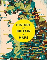
history_of_britain_in_mapsI’ve always been a fan of maps, so the History of Britain in Maps by Philip Parker is right up my street.

The book is ordered chronologically with each map getting a short page of text facing a page of the map, with some maps earning an additional double page spread. Except for the earliest periods the maps are contemporary.

The book has the air of written as a set of separate map captions with some repetition between maps relating to the same period.

There are some recurring themes through the book, maps for the pleasure of maps seem to play a role, as do military maps showing defensive positions or explaining military actions. Maps of ownership are also common. Finally there are maps for travel, first by road and then later by canal and railway. Also apparent is the evolution of mapmaking skills.

Aside from the exceedingly schematic representations of Britain on the Roman Rudge Cup from 130AD the earliest maps of Britain date to the medieval period and Matthew Paris, a Benedictine monk who was active around 1250AD. There are religious Mappa Mundi from slightly earlier but Britain is very much on the edge of these schematic representations of the religious world with Britain perched at the very edge, if visible at all.

The earliest map of Britain that looks like a map is Matthew Paris’s map of 1250AD. The shape of coast is heavily distorted but some names recognisable to the modern eye appear (such as my home county of Dorset). Rivers are prominent most likely because they were the key method of transport over longer distances. There is a strand of maps that portrays the nations of the British Isles, the counties within them and cities, particularly London which are about place, belonging and power rather than navigation or even defence. Towards the end of the 16th century such maps start to look very much like modern maps, they are relatively accurate and follow modern mapping conventions (rather than being panoramic views or schematic views).

Also produced by Paris is an "itinerary map" showing the progression of towns a pilgrim to the Holy Land would pass through on their trip from Britain. This type of map is a recurring theme through the book, it is not interested in the details of the landscape, it is not a plan view, it is a linear track with distances. This is highly relevant to the traveller who is constrained to travel along the roads rather than view the landscape from above, as a bird does. In some respects this path turns full circle with Beck’s highly schematic but very clear London Underground map.I was interested to learn that road signage was not introduced until 1696.

Although there are earlier examples of coastal maps Henry VIII’s dissolution of the monasteries in the 16th century which led to open season being declared on Britain by the Pope, produced a number of coastal maps of the South of England. These are a recurring theme. The monarch, and his counterparts in Europe, were both keen to map the defences of the South Coast. Similar maps were produced during the Napoleonic Wars and the Second World War. Also falling into the military remit are the various maps of military engagements of the Civil War. The earliest work of what was to become the Ordnance Survey in Scotland in the mid-18th century and then in Kent related to military interests (the clue is in the name).

Maps of ownership are another recurring theme, these start in the early 15th century typically establish the land and rights of the monasteries. Later maps, in the early 19th century, show the results of the Enclosure Acts which took from Common land from everyone and gave to the wealthy now-landowners. Similarly the tithe system whereby a tenth of the produce of an area was owed to the parish was converted to a land taxing system where money was given instead.

There are the 19th century "social" maps of cholera by Jon Snow’s, deprivation by Charles Booth and the census of 1841 by August Petermann. Fi

The book ends with a map of the votes cast in the 2016 EU referendum, a bitter topic as I write in January 2021. 

Obviously as a fan of maps, I enjoyed this book. It is a nice skim through British history if you don’t want anything too heavy going, it is also a good overview of what types of maps people were making and when. I’d seen quite a few of the maps shown in other books, you can get a flavour of these here on the maps tag of my blog.

Book review: The Address Book by Deirdre Mask

the_address_bookNext up is The Address Book by Deirdre Mask, this book is work related but to be honest I’d be reading it anyway. I work for a company, GBG, which provides address lookup services, it takes addresses typed by consumers and matches them to the definitive address data to provide a "clean" deliverable address. This means I have contemplated the structure of addresses, how they vary from country to country and how important they are for our day to day life.

The Address Book starts with some motivational chapters around why we should be interested in addresses, starting with a description of the situation in West Virginia where consistent street addressing was only introduced in the 1990s, and the problems that arise from this! Also included in this section are reports from Kolkata and Haiti.

In Kolkata the focus is on Addressing the Unaddressed, a charitable organisation which provides those living in slums with an "address" which enables them to access services. We often use an address as part of the identity of a person, a name is not enough. There are a number of Ian Hopkinson’s in the UK, and indeed around the world but I am the only one living at my address. In fact the Addressing the Unaddressed addresses are based on Google’s Plus Codes, these are not traditional street addresses, rather shorthand for latitude-longitude pairs. What3words provides a similar, closed source service. Mask discusses the shortcomings of such systems towards the end of the book. Essentially they provide no sense of community around living in shared labelled spaces.

In Haiti the discussion is around an outbreak of cholera, ultimately linked to the UN forces there to support the country after the 2010 earthquake but it starts with a discussion of Jon Snow and his famous work on the Broad Street pump. The importance of addressing is that when Snow was doing his work In London the General Registry Office had relatively recently (1837) started recording births and deaths, including the address at which they took place. This type of epidemiological study is not possible without street addressing, certainly not at that time. Nowadays we can use GPS devices to pinpoint deaths in the absence of addresses.

Addressing starts with street names, and in the UK, and other European countries street names started with function. Main Street, Church Lane are the more socially acceptable examples. However, as cities grew duplicate names became a problem. In 1853 London had 25 Victoria Streets and 25 Albert Streets. The pressure to add numbering to street names comes from centralised governments, if you want to take a census of your population to tax them or raise an army or plan services then numbered street addresses are pretty much essential. Registration of land ownership is also important. Such censuses generally started in the 18th century. Following on from this was the introduction of cheap, universal postage – which also requires street addressing. Requiring citizens to have surnames was part of the same process of enumerating the population.

The common scheme of using odd numbers on one side of a street and even on the other was invented by Clement Biddle in 1790, it is not the only system. There are other ways though, in Japan numbering is often by date of construction i.e. newer buildings have higher numbers. The Czech Republic has a dual numbering system, each address has a number used for navigation and a number used for government registrations. There are also systems where numbering is based on distance along a road.

The American scheme of numbering rather than naming streets, or at least naming them in a very systematic and often anodyne fashion dates back to Philadelphia and the Quakers involved in its founding. Quakers were not enthusiastic about naming things after people – hence the numbering system.

Circling back to street names, these are often intensely political, Mask talks about naming and commemoration in South Africa, America, Iran and Germany. In South Africa and America these disputes revolve around race, for South Africa it is to what degree figures from the apartheid era are celebrated, and what actions should exclude someone from commemoration in a street name. In America it is the celebration of Confederate figures that stirs passions. Iran likes to celebrate revolutionaries in its street names, and the case Mask cites is Bobby Sands, the IRA hunger striker – an uncomfortable topic for me as someone who is English (and grew up during the IRA bombing campaign in the seventies). Germany is included for its Nazification/De-Nazification process – after the Second World War many streets and places simply reverted back to pre-Nazi names. There are a surprising number of "Jew Streets" in Germany, Jewish people have long been restricted to living in particular places.

Naming and addressing are deeply personal, efforts to number houses are often resisted or treated with suspicion. The removal of long standing place names causes a sense of dislocation, the selection of names can cause distress. We’ve seen some of this in the UK with our branch of the Black Lives Matter movement.

In New York City there is a process for buying street addresses, so developers will pay money to get an address on a desirable street even if their building is not accessible from that street!

This is an enjoyable read, written in an approachable manner about a fascinating subject.

Book review: Sea monsters on Medieval and Renaissance Maps by Chet van Duzer

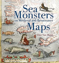
sea_monstersA borrowed book for my next review: Sea monsters on Medieval and Renaissance Maps by Chet van Duzer. Mrs H bought this as a by-product of buying a Christmas present on some quirky gifts site.

The book is well-described by its title, it is about sea monsters on medieval and Renaissance maps. Although a couple of classical antecedents are mentioned the main action starts in the 9th century and finishes at the beginning of the 17th century.

The book is organised roughly chronologically without chapters but with sections recorded in the contents – there are approximately 50 sections broken up by four "pictorial excursions". Much of the material is from the 16th century. As we go further back in time fewer and fewer examples of any sort of written or printed materials survive. Prior to 1472 any maps will have been reproduced by hand rather than printed.

Sea monsters were not found universally in maps through this period, in fact they were relatively rare. Adding sea monster was an additional cost and rarely added any useful information. The sea monsters were often drawn separately from the cartographic elements of the map, suggesting they were a specialisation. Sometimes they were direct copies from other sources. Sea monsters were often derived from recent scientific works, and influences can be seen across multiple maps. Sometimes the sea monsters depicted are playing a role in myths or stories such as Jonah and the whale, or the story of Saint Brendan who, on a voyage, is said to have landed on a whale, not realising its nature a fire was lit and the whale sank beneath them.

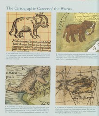
There is a lot of evidence of artist working from verbal descriptions of animals by non-expert observers. This is at a time before naturalists had been invented so observations of wildlife were not systematic. There’s a great double page spread illustrating the development of drawings of walruses from pretty much elephants to recognisable walruses(see below).

walruses_1walruses_2

Figure 1: The cartographic career of the Walrus

Sea monsters came in various forms, many reflected real animals we might see today, although rendered strangely as we see with the walrus. Others were human – animal hybrids such as mermaids. Finally there are the outright whimsical – various dragons, krakens, unicorns – owl faced creatures and the like.

Mappamundi were the earliest maps to contain sea monsters although they are not maps as we would recognise them, you couldn’t navigate by them. They were symbolic representations of the world both physical and spiritual, rather than being entirely useful for navigation. A common feature was that the focus in these maps on the land rather than the sea. I was confused by mentions of the Beatus mappamundi which appears in multiple locations before realising that these were copies of a single mappamundi which varied since they were manually created. The place name refers to a particular copy (i.e. Genoa or Manchester), and different copies have different sea monsters. They are based on a map found in the Commentary on the Apocalypse by Beatus of LiĆ©bana. This was written sometime in the 8th century and subsequently copied.

The earliest surviving navigational maps are from the 13th century, these are intended as more functional objects and initially focussed on the region around the Mediterranean. In contrast to the mappmundi, these maps were focussed on the sea and coastal areas. There were variants made which clearly played a more decorative role, collectors items that showed your wealth and knowledge. These maps were more likely to contain illustrations of sea monsters.

In addition to freestanding maps there were also illustrated versions of Ptolemy’s Geography which included sea monsters, although the Madrid version of 1455-60 is the only manuscript version to include such sea monsters. Later printed version contained more sea monsters.

The sea monsters in Olaus Magnus’s Nautical chart and description of the Northern lands and Wonders published in 1539 are particularly rich and varied. They can also be found copied in Mercator’s globe of 1541 and Euphrosynus Ulpius’s globe of 1542. Mercator was less eclectic in his collecting of sea monsters for his atlas of 1569.

The book finishes as the 17th century opens when fantastical sea monsters on maps largely fell out of favour to be replaced with more ships and practical illustrations of whaling and the like. The sea was no longer quite so mysterious and man was increasingly exerting control over it, and its contents.

This is a fun book, a nice present for a cartophile. It would have been good to have a timeline of the maps discussed. There is probably an interesting parallel book on the monsters seen in terrestrial maps of the same period.

Book review: How the States got their Shapes by Mark Stein

how_the_statesHow the States got their Shapes by Mark Stein is that book that does exactly what it says on the cover: explain the origin of the shapes of the states of the United States. The book starts with some broad brush strokes that underpin the shaping of many states before going through each State in alphabetical order.

States are not strictly comparable with European nations but it is interesting to compare the never-straight borders of Europe with the regularity of particularly Western states. To a British European the events described in the book are all terribly recent – much of the action occurs during the 19th century! I considered extending this statement to all Europeans but there has been quite a bit of change in national borders in Europe over the last 200 years.

The large scale features of the USA arise from a number of sources. The earliest of these originate from the French and Indian War in the mid-18th century which saw the England and the colonists take the territory around the Great Lakes from the French and subsequently take further land from the French in the Louisiana Purchase. Further to the west territory came from the Spanish and then a newly independent Mexico. The border with Canada was agreed largely at the 49th parallel with the British in 1818. Later the Dutch would cede their territory along the Hudson river and the Spanish the last of their territory in what is Florida.

There are some recurring themes determining the shapes of states, one that comes up repeatedly is the desire for Congress to create States of equal size, in the West there are sets of states with the same height (3o) and width (7o). This concept extended to access to resources, so the ports on the Great Lakes are shared amongst the surrounding States. A second big driving force is slavery, the Missouri Compromise placed a boundary at a latitude of 36o 30′ below which slavery was allowed, and above which it was not. This motivated boundaries of states, and led to a battle to create equal numbers of states above and below the line.

There are irregularities. Boston Corner looks like it should belong in  Massachusetts but is actually in New York state, this is because the terrain made access to Boston Corner from the rest of Massachusetts difficult. In the early days this type of inaccessibility led to lawlessness, so states were willing to cede territory to avoid it. Whole states were created to address potential lawlessness, when gold was discovered in what is now Idaho it was felt too distant from Oregon to be ruled from there with the influx of unruly gold miners. There was also a concern that they would displace the coastal Oregonians from government.

Sometimes a river makes a good boundary although when the river has tributaries things get a bit tricky, it is even worse when borders are defined with reference to “head waters” which are notoriously difficult to locate. The other problem with rivers is that they meander – meaning that chunks of a State may find themselves on the “wrong” side of a river when the river moves. In some cases surveying errors and mistakes in negotiations led to oddly formed borders.

The supersize California and Texas states are a result of their own origins in virtual nationhood. Texas was, for a brief period, an independent country which subsequently joined the Union. California formed with the influx of the miners who came for gold, the Union was more concerned that they join than try to enforce borders upon the new State.

The charters of the original US colonies which later evolved into states typically gave them territories that stretched all the way from the Atlantic to the Pacific coast, during the 17th and 18th centuries this was largely moot – colonies scarcely had the wherewithal to maintain small populations on the  Eastern seaboard. The British monarchs granting these charters were not necessarily consistent, or particularly well-advised. So some boundaries are defined by “headwaters” which are notoriously ill-defined.

It is inevitable that the book is a bit repetitive, after all every border has two sides. This is occasionally jarring but usually handled quite well with cross referencing.

Missing from this book is much reference to the Native Americans, they are mentioned as an aside in a few places but little more than that. There is another book in the territories of the Native Americans prior to the European colonisation of the country – I just don’t know where it is! This article on The best books on Native Americans and Colonisers looks like a good place to start.

Overall I quite enjoyed this book, I read most of it on a long train ride. I suspect maps and boundaries are a bit of a niche interest but I feel I also picked up the broad shape of the creation of the USA.