Tag: History

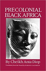
Book review: Precolonial Black Africa by Cheikh Anta Diop

diopMy next book follows on from reading Black and British by David Olusoga. It is Precolonial Black Africa by Cheikh Anta Diop. I was looking for an overview of African history from an African perspective. Diop’s relatively short book focuses on West Africa. It turns out he is a very interesting figure in himself, building several political parties, doing research in history as well as physics and chemistry and having a university named after him. Some of his ideas on African history are controversial (you can see the wikipedia page relating to him here).

The core of the controversy is two fold, one is his claim that ancient Egyptians were black, and the second is that there is a historical unity in West Africa civilisation with migration from the east of Africa populating the continent. The basis for this thesis relies quite heavily on similarities in totemic names across the region as well as cultural similarities. These days there is some support for the migration of populations out of the Nile basin to West Africa from DNA evidence.

Most of the discussion in this book is oriented around the area of West Africa where Diop grew up, in Senegal, with some mentions of Eygypt and Sudan. Diop draws parallels in the internal organisations across the empires of Ghana, Mossi, Mali and Songhai. The Empire of Ghana stretched beyond the boundaries of the modern country, and stood for 1250 years. Mossi was to the east and south, in the area of modern Burkino Faso, Mali and Songhai were a little to the north encompassing the modern Timbucktu. Looking at wikipedia these empires appear to have overlapped to a degree both in time and space. Precolonial Black Africa covers the period from about 300AD to the 17th century although it does not make much reference to dates.

There is almost no mention even of the area of Nigeria, a little to the east, or Southern Africa. I was nearly half way through the book before I realised that Sudan referred to two different places: Sudan the modern state in North East Africa, and the Sudan Empire which stretches across the southern margin of the Sahara in the West of Africa.

The books starts with a description of the caste system, emphasising the two-way nature of the system and contrasting it to a degree with the caste system in India.

Precolonial Black Africa contrasts Africa with Europe, in the period covered by the book Europe was based on city-states which evolved into feudal structures, with Roman geographical divisions, where defence from marauders by the lord in the castle was important. Land ownership was core of this political system whereas Africa evolved more along Egyptian lines which saw countries divided into regions with regional governance and no tradition of land ownership.

These empires were led by kings with a small cabinet of advisors who had both a regional responsibility and a specialism (like a minister for finance, or the army). Although not republics, nor democratic in the modern Western sense, Diop claims that these governments were more representative than their Western European equivalents of the time.

The technological expertise of the ancient Romans and Greeks was carried through the Middle Ages by the Arab world. It is no coincidence that Spain was once a technology leader, given the Muslim rule of Spain. Islamization of West Africa is a recurring theme of the book, and Arab writers feature regularly in the lists of sources for the early history of Africa. Islam was important in education through to the present day, this is in part responsible for slowed technological progress in the region. Islamic schools did not place a great emphasis on what they consider pagan history, nor so much on modern science.

Precolonial Black Africa covers technology relatively briefly, mentioning architecture and the Great Zimbabwe – a significant stone-built city in present day Zimbabwe whose early excavation was plagued by the then Rhodesian governments view that it could not be constructed by Black Africans. Coins, and metalworking are also mentioned – West Africa made relatively little use of the familiar coinage of European. Gold dust was used as currency, as were Cowrie shells. The Benin Bronzes dating from the 13th century demonstrate there was significant metalworking skill in West Africa (the Bronzes are currently in the news as the UK refuses to return them to Benin). Little of technology and writing seems to have survived from precolonial times, I suspect this is a combination of the environment which is not conducive to the preservation of paper (or even metal), successive colonisations by Islam and then Europeans and relatively little archaeological activity.Trade seemed quite significant across West Africa, even in the absence of conventional coinage.

The interesting thing reading this book is the contrast with flaws that Western history has had in the past, being focussed on great men, the idea of the natural superiority of the white man, and leaning heavily on Classical heritage for legitimacy. I suspect these points of view are generally not prevalent in modern academic history but they certainly hold sway with the current UK government and a coterie of right-wing historians. To a degree Diop suffers the same types of prejudices but from a different perspective – the superiority of the Black African. My view of African history is still heavily influenced by those old Western European foundations.  

After a rocky start I came to enjoy this book, I found the book alien in a couple of respects firstly in its discussion of history from an African perspective, and also simply that it is African history. What I know of Africa is largely through a colonial lens. 

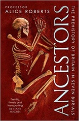
Book review: Ancestors by Professor Alice Roberts

ancestorsSomewhat unintentionally my next book, Ancestors by Alice Roberts, follows on from Hidden Histories by Mary-Ann Ochta and The Goddess and The Bull by Michael Balter. Ancesters is an investigation of the transition from early Stone Age people in Britain through the Neolithic, to the Bronze Age finally the Iron Age through the medium of seven burials around Britain. As well as the facts of various burials Roberts talks too about in archaeological methodology over time.

The broad context of the book is a project on recording ancient DNA in which Roberts is involved, a project on hold due to covid. Motivation for this is that we can observe the movement of ancient peoples and relationships between people in burials using DNA. These techniques have not been applied extensively to Neolithic remains to date.

The first burial discussed is of the "Red Lady" in a cave in the Paviland Cliffs on the Gower in Wales. It dates back to the Paleolithic (old Stone Age), 34,000 years ago and is the oldest burial discovered in Britain, from a period before the last Ice Age. William Buckland was the first to scientifically describe the burial, and his descriptions reflect the opinions of the time. He sought to reconcile such burials with biblical knowledge, and social mores, initially describing the burial as of a "Red Lady" because of the decorative grave goods (and the body being caked in red ochre). It turns out the burial is actually of a man!

As far as we can tell deliberate burials by homo sapiens date back about 100,000 years. The evidence is mixed as to whether Neanderthals practiced burials. This rubicon is seen as important since burial rites represent a move to modern human thinking which distinguishes us from other animals (so far!). I particularly enjoyed the description of the "flower people" where, in a burial in Iraq, it has never been quite clear whether Neolithic people buried people in flowers or whether it was actually the work of gerbils that, by the way, also gnawed on the body.

Returning to UK we meet Cheddar Man, who was buried after the last Ice Age about 10,000 years ago. Incidentally we learn how to wind up an anatomist with fake skeletons: in real life the pelvis and ribcage of a skeleton collapse because the ligaments don’t hold them together after they’ve been in the ground for a bit – fake skeletons don’t show this. At 14,700 years old other skeletons in Gough’s Cave, where Cheddar man was found, are the earliest post-Ice Age human remains found in Britain.

Cheddar Man was from the Paleolithic or old Stone Age, the next burials discussed are from the Neolithic or New Stone Age. The defining feature of the New Stone Age is the move from hunter/gathering to agriculture and settlement. The key question is whether this change in behaviour was a transmission of ideas, or an influx of people with these new habits. This transition to agriculture 11,000 years ago is one of the central themes of The Goddess and The Bull, in Britain the transition takes place a later – about 6,000 years ago.

Farming arrived in Britain with people, rather than just ideas. There’s evidence of violence in some of the burials discovered (about 10% of skulls show signs of traumatic injury) but as far as can be ascertained this was farmer/farmer violence rather than hunter-gatherer/farmer violence. It seems that hunter-gathering died out with its practitioners rather than its practitioners converting to farming. Something that I hadn’t heard of before was the idea of a "house burial" – some Neolithic burial barrows are on the site of dwellings, longhouses, which have been ritually burnt. Neolithic burial sites are often reused in the Bronze and Iron Age, perhaps to maintain contact with the land. Perhaps burial becomes more important once we start to stake a claim on particular pieces of land.

There’s a small diversion at this point to discuss Pitt Rivers, a 19th century archaeologist whose methodology was beyond his times in the sense that he made meticulous records of what he had dug. He was born Augustus Lane-Fox but changed his surname to Pitt Rivers as a condition of receiving a substantial inheritance. He spent his later years in detailed excavation of his inherited Rushmore Estate which lies close to Salisbury and is incredibly rich in archaeology (or perhaps if you are rich, an archaeologist and inherited a large estate it turns out there is a lot of archaeology you can do).

Next we move to Bronze Age burials, where things get exciting in terms of grave goods. Starting gently with some arrows and so forth we move on to whole, upright chariots including the horses in the Iron Age!! The Bronze Age is also marked by an influx of people. I recall from my Seventies childhood the Beaker People (identified by a particular type of pottery).

At this point, in the late Iron Age we transition from prehistory to history with Roman writings on Britain. Such records need to be treated with a little care since they are often second hand and are the viewpoint of a conqueror. It is interesting to see the names of Iron Age tribes carried forward to the present day, for example in the Parisi in Northern France (turning into Paris) and Durotriges turning into Dorset.

Roberts notes at the end of the book that burial practices don’t have to be universal across a period we consider to be discrete such as the Bronze Age, to the people living at the time they were not "Bronze Age" they were people of a much narrower place and time. Large changes in burial practices are not necessarily indicative of religious changes – Britain shifted from burial to cremation from the end of the 19th century to the Sixties with no change in religion.

The writing of the book stretched into the covid pandemic, it is an interesting mix of topics written in an engaging style. There are a couple of places where the editing slips a bit. Overall I found it an engaging read.

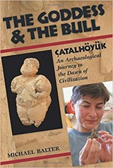
Book review: The Goddess & The Bull by Michael Balter

the_goddess_and_the_bullI like to vary my reading, so from my previous review on guitar riffs we go to Neolithic archaeology, specifically the archaeology of Çatalhöyük in The Goddess and The Bull by Michael Balter which carries the subtitle "Çatalhöyük – An Archaeological Journey to the Dawn of Civilization". Çatalhöyük featured in a recent TV programme "Raiders of the Lost Past with Janina Ramirez" which I recommend if it is still available – this is what prompted me to get this book.

Çatalhöyük, in Turkey, is a prehistoric township which was active between 7500BC and 6200BC, it reached a peak size of some 5000 residence and as such it notable for being one of the largest of the early Neolithic settlements.

The Goddess intertwines several themes, it provides some biographical detail of the key archaeologists involved in the dig, it talks a bit about the evolution of archaeological methodology, and it talks about what was found at Çatalhöyük and the wider human activity in the Neolithic period. This is laid out in chapters that proceed chronologically with each chapter mixing elements of biography, methodology and the Neolithic period.

Any story of Çatalhöyük starts with James Mellaart, the first archaeologist to dig the site in the early 1960s. It’s fair to say he was a bit of a character. When he arrived in Turkey in the 1950s the Neolithic remnants were little known and he discovered hundreds of sites in his tour, on foot, of the area. These were largely in the form of "tells", large mounds built of successive layers of settlement made one on top of another. Çatalhöyük stood out because it was large, and it was early Neolithic from top to bottom. Many of the tells were occupied over very long periods of time so the earliest archaeology was obliterated by the later.

After digs at Çatalhöyük between 1961 and 1965, Mellaart was banished by the Turkish authorities following accusations of facilitating the sale of archaeological artefacts. His case was not help by the "Dorak Affair" in 1958 in which a mysterious woman showed him a range of artefacts from the Neolithic which he dutiful wrote up in various articles – these artefacts never saw the light of a museum and the Turkish authorities suspected Mellaart in their disappearance. The mysterious woman has never been found. Over the rest of his life Mellaart continued to publish on Çatalhöyük, later articles becoming somewhat fanciful.

I found it striking how much of the archaeological work done in the Middle East was done by British, American and other Western European archaeologists, often with their own institutes in-country. It feels like a water-down version of the bad old days of the 19th century where Europeans pillaged the countries of the ancient world for artefacts, although it is clear these 20th century ventures were much more under the control of the "home" countries.

Also relating to politics, the book highlights how much modern archaeology is funded as rescue work, during the construction of roads and railways in the UK, and frequently dams and hydro-electric schemes in the Middle East. In the nineties phase of digging at Çatalhöyük, Ian Hodder, the director of the work, spent a lot of time fundraising from both public and commercial sources.

From a methodological point of view, Mellaart’s first archaeological digs were based on the vertical stratigraphic approach borrowed from geologists which had been made popular in the forties and fifties by Kenyon and Wheeler. Here layers of a site are stripped back successively to establish a chronology, aiming for depth rather than breadth. This replaced the 19th century approach of broad area excavation where discovering the horizontal extents of a site was the priority, as was the discovery of "treasure", I suspect. Following Mellaart’s excavation the "New Archaeology" arose which became the "Processual" movement in which the emphasis was on highly detailed digging and analysis with a view to testing hypothesis. Earlier schemes being more interested in cultural artefacts. In a nutshell, the processual view saw different forms of stone axes representing different uses, whilst the previous view saw different axes as representing different cultures.

Ian Hodder represented a further evolution in methodology, post-processualism which included the intensive specialist sampling of the processualists but added more context from sociology and anthropology, and even the subjective feelings of the archaeologists as they worked. Pierre Bourdieu, a French sociologist and a bête noire in our household, is mentioned! Hodder took over the excavation of Çatalhöyük in the earlier nineties, and continued through to the completion of this book in 2006, and beyond until 2017 when digging seems to have stopped at Çatalhöyük.

The core question around the Neolithic era was what made Palaeolithic hunter-gatherers settle and take up farming, and how did they do this. There is some evidence that settling, living in permanent villages occurred some time before farming started. But why did farming start? Why did settling start?

There isn’t really a conclusive answer to this. Çatalhöyük, as a substantial Neolithic settlement, is pre-dated by a short spell by sites such as Jericho. It is comprised on many relatively small dwellings with common features: evidence of a ladder and an oven on the south wall, indicating access from the roof, numerous human burials under the floors. There is no evidence of specialist or communal buildings or a social hierarchy. The walls of the buildings were decorated, sometimes with bulls’ skulls or vulture heads inside them. It seems that buildings were ritually burnt at the end of their lives, typically after one hundred or so years of occupation. The people ate cultivated crops, and domesticated sheep and goats and some wild cattle, more of the wild cattle during what appear to have been ceremonial meals.

One theme from the sixties epoch of excavation that didn’t make it through to the nineties was the idea of Goddess worship, in the sixties there was some enthusiasm for the idea that Çatalhöyük represented a matriarchal society which worshipped a goddess. This idea does not seem strongly supported by the archaeology, although there are a number of "goddess" statues discovered they are all small and not found in particularly salubrious situations. There is more evidence for the idea that the bull was venerated – I wonder about the links between this and the position of cows as sacred animals in Hinduism, and also its role as a pictogram that evolved into the letter "a".

I really enjoyed The Goddess and The Bull, having approached it somewhat sceptically because it was not the recommended book by experts (James Mellaart: the journey to Çatalhöyük by Alan Mellaart) and it wasn’t clear whether it was an intensely academic volume. The biographical material of the archaeologists is sometimes a little grating but it makes the book more readable. I felt I learnt a lot about archaeology and the Neolithic. There’s a website www.catalhoyuk.com, where you can see the latest developments – including annual reports up to 2017.

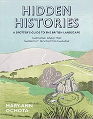
Book review: Hidden Histories by Mary-Ann Ochota

For my next book I read hidden-historiesHidden Histories: A spotter’s guide to the British Landscape by Mary-Ann Ochota. As a countryside walker and cyclists of many years, I’ve always been interested in what I saw and how it came to be, Hidden Histories is just the book for me.
The book is divided into broad sections: lumps and bumps, stones, lines and "in the village" and within each of these sections there are 10 or so topics covered over a few pages each. There are many illustrations, and photographs on pretty much every page. Domestic buildings and churches are covered but castles and stately homes are not which is not unreasonable.

If there is a gap it is in the coverage of industrial landscapes which is limited, this reflects my interests and where I have lived, and holidayed, as much as anything.

"Lumps and bumps" covers long barrows (collective burials dating back to the Neolithic), round barrows (single burials, found in nearly every parish dating back to the Bronze Age), hillforts (defensive earthworks from the Iron Age), miscellaneous earthworks and the ridge-and-furrow plough system. I was interested to learn that windmill bases can be mistaken for round barrows. One learning of this section is that there are only known burials for about 10% of the estimated population of prehistoric Britain. I grew up in Dorset which makes frequent appearances in this part of the book. Maiden Castle was a regular walking spot – it is the biggest Iron Age hillfort in Europe.

The ridge-and-furrow plough systems makes a re-appearance in the section on lines. Essentially visible ridge-and-furrow systems are usually at least seven centuries old and are the result of the medieval method of farming with ox-drawn ploughs which leave a shallow S-shaped furrow. This gentle S-shape is also seen in ancient field boundaries. The way land was owned and shared is also relevant, in medieval times land was common with patches exploited by individuals but individual plots did not have hedge boundaries. This ended with the Enclosures Acts in the 18th and 19th century that made land ownership more individual although in principle it shared land equitably in practice it favoured the rich who had the resources to exploit land in line with the new Acts. Enclosure Acts were particularly important in the Midlands and had widespread impacts on both people and the landscape.

"Stones" covers standing stones, stones in circles,stones in lines, stones with symbols on them, stone crosses, stone tools and wayside markers (stone ones!). Standing stones are difficult to date, and Stonehenge is pretty unique in that its constituent parts are not local, usually stone circles are built from local stone.

"Lines" talks about Roman roads, and other ancient pathways before moving on to the shapes of fields and various chalk figures. I grew up just down the road from the impressive Cerne Abbas giant which is 2000 years old, there is also a white horse on the hillside into Weymouth but that is of George III and dates back to 1808. I hadn’t appreciated that chalk figures require very regular maintenance which is impressive considering the Uffington white horse dates back to 1400BC.

Holloways have a number of mentions – these are ancient routes that have been worn below the prevailing ground level by use. It is chastening that after the Romans left their road building skills were not surpassed until the turnpike roads were introduced a thousand years later.

"In the village" covers various buildings found in villages, mainly houses and churches but briefly mentioning pubs and barns. The age of homes is of direct professional interest for me, although the focus of Hidden Histories is older buildings. I was bemused to learn that the term "Gothic" was originally applied as an insult coined in the 1600s to describe what they saw as overly ornate buildings from the 1200-1500s.

I learnt a wide range of useful facts from this book, such as "metalled" roads being derived from the Latin for "quarry" which has always puzzled me! I also learnt that "turbary" refers to peat workings, so I have learnt a new word to slip into conversation.

I’m interested in maps and computers so it struck me there are some interesting things to do in geospatial analysis relating to this book. For example, medieval ridge-and-furrow ploughing shows up quite nicely in LIDAR, as do other earthworks. Similarly field boundaries and place names, and other mapping features, are all in Ordnance Survey mapping products and these days are readily accessible by automated means.

Cheshire, where I live now, has few entries although on this morning’s cycle I was spotting what I now know to be Enclosure Act hedging with oak "standards" spread along it. Hidden Histories satisfies a curiosity I’ve always had about the countryside I’ve been traveling through.

Book Review: History of Britain in Maps by Philip Parker

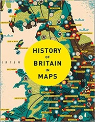
history_of_britain_in_mapsI’ve always been a fan of maps, so the History of Britain in Maps by Philip Parker is right up my street.

The book is ordered chronologically with each map getting a short page of text facing a page of the map, with some maps earning an additional double page spread. Except for the earliest periods the maps are contemporary.

The book has the air of written as a set of separate map captions with some repetition between maps relating to the same period.

There are some recurring themes through the book, maps for the pleasure of maps seem to play a role, as do military maps showing defensive positions or explaining military actions. Maps of ownership are also common. Finally there are maps for travel, first by road and then later by canal and railway. Also apparent is the evolution of mapmaking skills.

Aside from the exceedingly schematic representations of Britain on the Roman Rudge Cup from 130AD the earliest maps of Britain date to the medieval period and Matthew Paris, a Benedictine monk who was active around 1250AD. There are religious Mappa Mundi from slightly earlier but Britain is very much on the edge of these schematic representations of the religious world with Britain perched at the very edge, if visible at all.

The earliest map of Britain that looks like a map is Matthew Paris’s map of 1250AD. The shape of coast is heavily distorted but some names recognisable to the modern eye appear (such as my home county of Dorset). Rivers are prominent most likely because they were the key method of transport over longer distances. There is a strand of maps that portrays the nations of the British Isles, the counties within them and cities, particularly London which are about place, belonging and power rather than navigation or even defence. Towards the end of the 16th century such maps start to look very much like modern maps, they are relatively accurate and follow modern mapping conventions (rather than being panoramic views or schematic views).

Also produced by Paris is an "itinerary map" showing the progression of towns a pilgrim to the Holy Land would pass through on their trip from Britain. This type of map is a recurring theme through the book, it is not interested in the details of the landscape, it is not a plan view, it is a linear track with distances. This is highly relevant to the traveller who is constrained to travel along the roads rather than view the landscape from above, as a bird does. In some respects this path turns full circle with Beck’s highly schematic but very clear London Underground map.I was interested to learn that road signage was not introduced until 1696.

Although there are earlier examples of coastal maps Henry VIII’s dissolution of the monasteries in the 16th century which led to open season being declared on Britain by the Pope, produced a number of coastal maps of the South of England. These are a recurring theme. The monarch, and his counterparts in Europe, were both keen to map the defences of the South Coast. Similar maps were produced during the Napoleonic Wars and the Second World War. Also falling into the military remit are the various maps of military engagements of the Civil War. The earliest work of what was to become the Ordnance Survey in Scotland in the mid-18th century and then in Kent related to military interests (the clue is in the name).

Maps of ownership are another recurring theme, these start in the early 15th century typically establish the land and rights of the monasteries. Later maps, in the early 19th century, show the results of the Enclosure Acts which took from Common land from everyone and gave to the wealthy now-landowners. Similarly the tithe system whereby a tenth of the produce of an area was owed to the parish was converted to a land taxing system where money was given instead.

There are the 19th century "social" maps of cholera by Jon Snow’s, deprivation by Charles Booth and the census of 1841 by August Petermann. Fi

The book ends with a map of the votes cast in the 2016 EU referendum, a bitter topic as I write in January 2021. 

Obviously as a fan of maps, I enjoyed this book. It is a nice skim through British history if you don’t want anything too heavy going, it is also a good overview of what types of maps people were making and when. I’d seen quite a few of the maps shown in other books, you can get a flavour of these here on the maps tag of my blog.