Tag: History

Book review: Black and British: A Forgotten History by David Olusoga

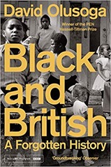
black_and_britishSince October was Black History Month I thought Black and British: A Forgotten History by David Olusoga would make a very appropriate read. Although, to be honest, I bought it before I realised and in all likelihood by the time you read this Black History Month will have finished.

The first thing that struck me about this book was the Preface where Olusoga writes about his motivation for writing the book. As a British-Nigerian this is visceral, the talk by Enoch Powell of “sending back” non-white citizens of Britain meant he feared he would be separated from his family as a boy. When the National Front were hounding people out of their homes, it was he who was being hounded out. This is absolutely in no way a criticism of Olusoga, or a reason to ignore the contents of this book. It is to contrast with my own detached, academic position as a white British reader.

Following an introduction which gives an outline of the contents of the whole book, the chapters proceed in chronological order with some themes relating to the same time covered in separate chapters. I’ve listed these out at the end of this review as a reminder to myself as much as anything.

There have been black people in Britain for thousands of years, the very first were identified during the Roman occupation. The ancient Romans and Greeks knew of Africa and sub-Saharan Africa, and the nature of the Roman Empire was that its subjects were mobile to a degree. After the fall of the Roman Empire, access to Africa was via the Arab/Muslim empire across North Africa with little contact with Europe. As a consequence European knowledge of African was limited to myths. The story picks up again in the 15th century with the Portuguese exploring the West African coast, they also started the slave trade in black Africans. The British took the first tentative steps in the “triangular slave trade” in the 16th century. The triangle trade saw the movement of manufactured goods from Britain to Africa, slaves from Africa to American and raw materials, sugar, tobacco, and cotton back to Britain.

At this time the West African states were powerful, and experienced in trade with the Portuguese and before them the Arabs. European explorers and merchants suffered large loses to disease – a situation which persisted into the 19th century. Black Africans were found as translators, and sailors, even courtiers in Britain. In Lisbon they made up as much as 20% of the population in the 16th century. They were the subject of curiosity, apparently little specific malice due to their colour, but lived under the Christian view that whiteness represented purity, and blackness the opposite.

British involvement in the slave trade picked up as it acquired colonies in the West Indies and US, the production of sugar and tobacco was lucrative if you had a good supply of cheap (slave) labour. It is at this point that black African slaves are dehumanised, the 1661 Barbados Slave Code puts this in writing. Plantation owners in the West Indies cannot see black Africans as human, they are too numerous and too economically valuable to be seen as such. The Royal African Company is formed as an exclusive vehicle for the slave trade in Britain, and is to take up to 75% of the slave trade in the late 17th century and early 18th century.

In Britain the situation is a bit different, there are a growing number of black people, often brought as the property of wealthy slavers, traders and plantation owners. But their legal status in Britain is hazy, and kept deliberately so for much of the 18th century. In the second half of the 18th century Granville Sharp started a campaign to release slaves in Britain, and later to campaign against slavery itself.  There was a degree of romanticism in the view that British air was too pure for a slave to breathe, so that none were slaves whilst at the same time profiting massively from slavery. From this start the Abolitionist movement grew, first ending British involvement in the slave trade (with Wilberforces 1807 bill), ending slavery in the West Indies in 1838 and then going on to try to end slavery globally.

This was seen as a moral crusade by the British, although there was a lively circuit of African-American speakers promoting the cause in Britain. Olusoga points out that the British have always been much more willing to talk about Abolition than slavery. In this context black Africans are still not seen as equal people, at least by some Abolitionists, but rather they wish to end slavery in the same way as they wish to see the end of cruelty to animals and children.

Freetown in Sierra Leone became an important location in the story, former slaves played a part fighting on the side of the British in the American Revolution, and their payment was freedom. Britain was squeamish about giving them their freedom in Britain. Some went to Nova Scotia, but there was also a plan to establish Freetown in Sierra Leone. The first attempt at this failed abysmally but eventually a colony was established there and the traces of that early history still remain in the modern city.

The British public appeared fairly well disposed towards black people in the first half of the 19th century but in the second half of the century there was a rise in Social Darwinism and scientific racism. Black people were increasingly spoken off as being mentally inferior, often child-like. These ideas grew from Darwin’s theory of evolution but they were motivated by a desire for conquest. In the final 30 years of the 19th century the white European powers colonised 90% of Africa in the “Scramble for Africa”. A theme that was to recur through the 20th century was an aversion to inter-racial relationships, specifically children fathered by black men with white women.

Britain’s attitude to black men for the two world wars was ambivalent, in both cases they were desperate for soldiers but, particularly in the First World War, very keen that black men should not fight white men – worrying this would give them unhelpful ideas when they returned to their homes in the minority white run colonies. In the Second World War the key feature was the huge influx of African American GIs to Britain, and the greatest issue was the treatment of Africa American GIs by their white colleagues (it was atrocious). British civilians were appalled by this. However in the aftermath of both wars there were racially motivated attacks on black men by organised white mobs. The motivation for this, at least in part, was that demobilised white men felt that black men had jobs that were rightfully theirs and economic times were hard. The official response to this was unhelpful to say the least, largely treating the black men as the transgressors. This treatment echoes down the years, and was part of the mis-trust of the police that fuelled the riots of the early eighties and, if we are honest, is still current today.

The book finishes with the post-war period, looking at the passengers on the Empire Windrush and the rise of Enoch Powell. The cry started by Powell in the seventies was to “send them back”, and picked up by the National Front. Powell was a culmination of a tacit program by governments of both stripes to justify the exclusion of black immigrants which had been ongoing since the Second World War. It was during the sixties that the public started to think the same way in larger numbers.

For West Indians and Africans from a number of modern states, Britain is the “home country”, in the same way as it is for white Canadians, New Zealanders and Australians. The difference is that immigrants from these countries are broadly officially welcomed and have been since the end of the British Empire. Black people have not been given that welcome.

Black and British is quite a long read, it packs a lot in but it is well-structured and readable. For me, as a white British middle class man, Olusoga presents from quite a different viewpoint. This is sometimes uncomfortable but I think necessarily so. It helps make more sense of the recent Black Lives Matter movement, but also the racism of the 1970s and the riots of the early eighties, in Britain, with smaller recurrences more recently.

Chapter Themes

  1. Sons of Ham – black people in Roman Britain and onwards, the start of the British slave trade in the 16th century;
  2. Blackamoors – black people in Tudor Britain, the development of the slave trade through to the end of the 18th century to service the tobacco and sugar plantations in the West Indies and America;
  3. For Blacks or Dogs – black people in Georgian Britain, the overspill of the slave trade;
  4. Too Pure an Air for Slaves – Granville Sharp and the start of the Abolitionist movement in the late 18th Century;
  5. Province of Freedom – Africa Americans and the American Revolution, leading to the foundation of Freetown in Sierra Leone;
  6. The Monster is Dead – the path to Abolition with the trade banned in 1806 and slavery  in the West Indies banned in 1838;
  7. Moral Mission – British mission to end slavery around the world in the Victorian period, with black speakers touring Britain. Minstrelism;
  8. Liberated Africans – the West Africa Squadron, aiming to abolish slavery by military means, the conquest of Lagos;
  9. Cotton is King – the US civil war and its impact on the cotton mills of northern England;
  10. Mercy in a Massacre – the rise of Social Darwinism and scientific racism in the second half of the 19th century;
  11. Darkest Africa – the 30 year Scrabble for Africa, when the Europeans colonised all but Ethiopia and Liberia. The rise of human zoos;
  12. We are a Coloured Empire – World War I and the black British Empire;
  13. We Prefer their Company – World War II and African American GIs;
  14. Swamped – immigration to post-war Britain;

Book review: A house through time by David Olusoga & Melanie Backe-Hansen

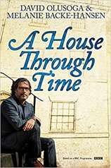
olusogaI’ve recently enjoyed watching A house through time, a series presented by David Olusoga tracking the history of a single house and its inhabitants across the years. The most recent series looked at house in Bristol, the city where I was an undergraduate. A house through time by David Olusoga and Melanie Backe-Hansen is the book of the series.

Rather than focus on a single house, as the TV series does, the book is a much broader sweep which looks at the history of the domestic dwelling back to Roman times, research methods and some social history which gives the “why” behind the houses.

This is a busman’s holiday for me, a large chunk of my job over the last few years has been to build a property database to help answer buildings insurance application questions. One of these questions is the property age, and it has been the cause of greatest pain for me. A house is a good background to this type of work, it provides the type of context which can be really helpful in understanding the data I come across. The issue for me though is that A house is written for those wishing to understand their own homes, rather than work out property age for 25 million or so dwellings but this is a niche interest and shouldn’t be taken as a criticism.

The book starts with a chapter on methods: how do you find out about your house? This is supported by an extensive set of links and a bibliography which strikes the happy medium between not providing any references, and referencing alternate words. The Census, and various surveys conducted before and during World War II are core to this, although these are ostensibly about people they provide evidence that an address existed at a point in time give or take variability in addresses and levels of details in addresses. Numbering of houses, as opposed to names, only started to rise in the middle of the 18th century. Also relevant are Ordnance Survey’s historical maps.

I was a bit surprised that there was very little mention of the listed building data, English Heritage and its partner organisations in Wales and Scotland aim to list all building built in the Georgian period and before. The data provides descriptions of the listed structures, this is the entry for 10 Guinea Street, Bristol which featured in one of the TV programmes.

There then follows a set of chapters on different periods, working forward in time covering the pre-Georgian, Georgian, Victorian, Interwar and post-war periods. These are the divisions I use in my work with the insurance industry (with the addition of a modern period starting in 1980).

There are a number of themes threaded through the book, much of the technological development of home building was relatively early. After the Roman’s left Britons reverted to living in wattle-and-daub or timber buildings for 400 years. The next significant technological developments were the discovery, and widening use of the chimney in the late 14th century followed by the re-discovery of brick making in the later 15th century. After that the next clear developments in building were in prefabricated and high-rise buildings post-Second World War.

A second theme is the legislative framework in which buildings wear built, these are two-fold there are “public safety” acts which are used to try to ensure safer buildings are built, these include the laws put in place after the Great Fire and those used to address the unsanitary conditions in Victorian slums in the later 19th century. These acts often specified a limited number of “model” properties and wonder whether these can be used for dating. There were also acts relating to taxation: window and brick taxes. It is the brick taxes that led to the standardisation of bricks, originally bricks were taxed by number so people made larger bricks so as to reduce their tax bills!

It is perhaps inevitable that the Victorian period running from 1837 to 1901 takes a large chunk of the book. This was a time during which there was a great move to the cities in support of the industrial revolution and a degree of “push” with the Inclosures Acts, Slum dwelling grew common, sanitation and urban clearances were initiated to relieve the slum conditions and the suburbs grew – supported first by omnibuses and then by railways. Although overcrowding and insanitary conditions were recognised early in the Victorian period addressing them took some time, with major improvements in the sewerage system happening towards the end of the 19th century. Often “improvement” schemes were more about sweeping aside the poor with no regard as to where they might live.

Towards the end of the Victorian period the suburbs started to grow, enabled by omnibus and then rail transport. It is at this time that semi-detached properties started to become common. The early suburbs gave me the impression of more rural aspects than modern suburbs. Some of the homes built in the late 19th century are very similar to those built in great numbers between the wars. It was only after the First World War that state intervention in building homes became widespread, the green shoots of this movement started in the late 19th century.

Sadly there is little scope for me to apply these methods to my own homes, I have nearly always lived in late sixties or seventies homes oddly they have had house numbers clustered around 30. In Bristol, as a student I lived in a basement flat close to the developments by Benjamin Stickland built around 1850.

I found A house really readable, it would be a great starting point if you were looking into the history of your own house or were just interested to understand how the domestic built environment came into being in the United Kingdom.

Book review: 1491 by Charles C. Mann

1491I read 1491: New revelations of the Americas before Columbus by Charles C. Mann as a follow up to How the States got their Shapes by Mark Stein. I had been frustrated at how this latter book had focussed on the colonial period, with native Americans almost completely elided.

The book tracks through three broad themes looking at those themes as they relate to Amazonia in the South, through Peru into central America and then into North America. The emphasis is around central America and the more northern parts of South America. I think this is a result of where the archaeology are found. 

The first theme is the numbers of native Americans in the time before colonisation, the broad picture here is that the population was large prior to colonisation, and in places still high as colonisation started but it was reduced dramatically by disease brought by the colonists – figures as high as a 90% reduction are discussed. The native Americans were highly vulnerable to the diseases the Europeans brought, both because they were genetically less diverse than the Europeans, and they had never experienced anything like the diseases brought. Initial contact between Europeans and Americans took place in the 16th century, with more serious attempts at colonisation not getting under way for a century, by which point disease had taken its toll. In an appendix Mann discusses whether syphilis travelled to Europe from the Americas, the evidence here is not clear.

The European view of the pre-colonial population of the Americas has varied, with the initial explorers recognising the sizeable populations of in the lands they found but as colonisation continued those memories were lost as the native population plummeted. Furthermore it was in the interests of the colonists to see the Americas as empty land, rather than land they took from others. During the 20th century these views have slowly been revised although there is considerable debate over exactly the scale of death through disease.

The second theme is origins: when were humans first found in the Americas? During the early part of the 20th century the view developed that the first human settlers in the Americas arrived over a land bridge from Asia around 15,000 years ago – the so called Clovis people. Towards the end of the 20th century this view has been revised with earliest origins going back to 30,000 or so years ago. In any case there were significant civilisations leaving behind ruins and burials dating back to 7,000 years ago. 

The final theme is landscape, to what degree is the landscape we see in the Americas human-made? Here it seems that Europeans have one view of a human-made landscape which does not match what is found in the Americas. The Americas are the origin to a huge variety of important agricultural crops (potatoes, maize, peppers, cassava/manioc and squashes) but they are not found in the fields associated with European agriculture but more in cultivated woodland. This dichotomy is perhaps starkest in Amazonia where there is still considerable dispute as to what civilisations once lived there, if any, and to what degree the Amazonian rainforest is human-made. Again this is tinged with modern European and colonial sentiments, in particular from a conservationist point of view it is preferable to see the Amazon as an untouched wilderness rather than a landscape shaped by humans since this provides a strong argument against allowing (renewed) development.

American cities both North and South were often different from European cities, commerce has always been important in European cities but in the Americans cities were often great ritual centres with living accommodation for farmers and other workers but little sign of trade.

In a coda Mann discusses the potential impact that the egalitarian Haudenosaunee alliance had on the founding fathers of the United States. Mann is clear that his view on this is not yet mainstream but highlights that principles of the founding fathers were closer to those of the Haundenosaunee than those of the class-based hierarchy of European countries. Early colonists had extensive interactions with the native Americans, and it wasn’t unknown for them to join their communities seeing them as more congenial than their own.

The book finishes with appendices on names, the khipu system of writing with knots, syphilis and the Mesoamerican calendars. I must admit I bristled early on at the use of the term “Indian”, rather than “native American” but as Mann highlights “Indians” usually use the term “Indian” themselves without objection in the relevant context and he uses “Indian” and “native American” interchangeable simply to introduce a degree of variety. More generally he attempts to use the name that a member of a group would prefer to use for that group. It parallels my preference to be called European, British, English, from Dorset or from Cheshire depending on context. 

I must admit I was aiming for a book that covered North American pre-colonial history in more detail. That said 1491 is readable, covering a great deal of ground. My next step is probably to look for a history of the Haudenosaunee.

Book review: Sea monsters on Medieval and Renaissance Maps by Chet van Duzer

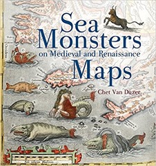
sea_monstersA borrowed book for my next review: Sea monsters on Medieval and Renaissance Maps by Chet van Duzer. Mrs H bought this as a by-product of buying a Christmas present on some quirky gifts site.

The book is well-described by its title, it is about sea monsters on medieval and Renaissance maps. Although a couple of classical antecedents are mentioned the main action starts in the 9th century and finishes at the beginning of the 17th century.

The book is organised roughly chronologically without chapters but with sections recorded in the contents – there are approximately 50 sections broken up by four "pictorial excursions". Much of the material is from the 16th century. As we go further back in time fewer and fewer examples of any sort of written or printed materials survive. Prior to 1472 any maps will have been reproduced by hand rather than printed.

Sea monsters were not found universally in maps through this period, in fact they were relatively rare. Adding sea monster was an additional cost and rarely added any useful information. The sea monsters were often drawn separately from the cartographic elements of the map, suggesting they were a specialisation. Sometimes they were direct copies from other sources. Sea monsters were often derived from recent scientific works, and influences can be seen across multiple maps. Sometimes the sea monsters depicted are playing a role in myths or stories such as Jonah and the whale, or the story of Saint Brendan who, on a voyage, is said to have landed on a whale, not realising its nature a fire was lit and the whale sank beneath them.

There is a lot of evidence of artist working from verbal descriptions of animals by non-expert observers. This is at a time before naturalists had been invented so observations of wildlife were not systematic. There’s a great double page spread illustrating the development of drawings of walruses from pretty much elephants to recognisable walruses(see below).

walruses_1walruses_2

Figure 1: The cartographic career of the Walrus

Sea monsters came in various forms, many reflected real animals we might see today, although rendered strangely as we see with the walrus. Others were human – animal hybrids such as mermaids. Finally there are the outright whimsical – various dragons, krakens, unicorns – owl faced creatures and the like.

Mappamundi were the earliest maps to contain sea monsters although they are not maps as we would recognise them, you couldn’t navigate by them. They were symbolic representations of the world both physical and spiritual, rather than being entirely useful for navigation. A common feature was that the focus in these maps on the land rather than the sea. I was confused by mentions of the Beatus mappamundi which appears in multiple locations before realising that these were copies of a single mappamundi which varied since they were manually created. The place name refers to a particular copy (i.e. Genoa or Manchester), and different copies have different sea monsters. They are based on a map found in the Commentary on the Apocalypse by Beatus of Liébana. This was written sometime in the 8th century and subsequently copied.

The earliest surviving navigational maps are from the 13th century, these are intended as more functional objects and initially focussed on the region around the Mediterranean. In contrast to the mappmundi, these maps were focussed on the sea and coastal areas. There were variants made which clearly played a more decorative role, collectors items that showed your wealth and knowledge. These maps were more likely to contain illustrations of sea monsters.

In addition to freestanding maps there were also illustrated versions of Ptolemy’s Geography which included sea monsters, although the Madrid version of 1455-60 is the only manuscript version to include such sea monsters. Later printed version contained more sea monsters.

The sea monsters in Olaus Magnus’s Nautical chart and description of the Northern lands and Wonders published in 1539 are particularly rich and varied. They can also be found copied in Mercator’s globe of 1541 and Euphrosynus Ulpius’s globe of 1542. Mercator was less eclectic in his collecting of sea monsters for his atlas of 1569.

The book finishes as the 17th century opens when fantastical sea monsters on maps largely fell out of favour to be replaced with more ships and practical illustrations of whaling and the like. The sea was no longer quite so mysterious and man was increasingly exerting control over it, and its contents.

This is a fun book, a nice present for a cartophile. It would have been good to have a timeline of the maps discussed. There is probably an interesting parallel book on the monsters seen in terrestrial maps of the same period.

Book review: How the States got their Shapes by Mark Stein

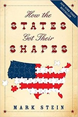
how_the_statesHow the States got their Shapes by Mark Stein is that book that does exactly what it says on the cover: explain the origin of the shapes of the states of the United States. The book starts with some broad brush strokes that underpin the shaping of many states before going through each State in alphabetical order.

States are not strictly comparable with European nations but it is interesting to compare the never-straight borders of Europe with the regularity of particularly Western states. To a British European the events described in the book are all terribly recent – much of the action occurs during the 19th century! I considered extending this statement to all Europeans but there has been quite a bit of change in national borders in Europe over the last 200 years.

The large scale features of the USA arise from a number of sources. The earliest of these originate from the French and Indian War in the mid-18th century which saw the England and the colonists take the territory around the Great Lakes from the French and subsequently take further land from the French in the Louisiana Purchase. Further to the west territory came from the Spanish and then a newly independent Mexico. The border with Canada was agreed largely at the 49th parallel with the British in 1818. Later the Dutch would cede their territory along the Hudson river and the Spanish the last of their territory in what is Florida.

There are some recurring themes determining the shapes of states, one that comes up repeatedly is the desire for Congress to create States of equal size, in the West there are sets of states with the same height (3o) and width (7o). This concept extended to access to resources, so the ports on the Great Lakes are shared amongst the surrounding States. A second big driving force is slavery, the Missouri Compromise placed a boundary at a latitude of 36o 30′ below which slavery was allowed, and above which it was not. This motivated boundaries of states, and led to a battle to create equal numbers of states above and below the line.

There are irregularities. Boston Corner looks like it should belong in  Massachusetts but is actually in New York state, this is because the terrain made access to Boston Corner from the rest of Massachusetts difficult. In the early days this type of inaccessibility led to lawlessness, so states were willing to cede territory to avoid it. Whole states were created to address potential lawlessness, when gold was discovered in what is now Idaho it was felt too distant from Oregon to be ruled from there with the influx of unruly gold miners. There was also a concern that they would displace the coastal Oregonians from government.

Sometimes a river makes a good boundary although when the river has tributaries things get a bit tricky, it is even worse when borders are defined with reference to “head waters” which are notoriously difficult to locate. The other problem with rivers is that they meander – meaning that chunks of a State may find themselves on the “wrong” side of a river when the river moves. In some cases surveying errors and mistakes in negotiations led to oddly formed borders.

The supersize California and Texas states are a result of their own origins in virtual nationhood. Texas was, for a brief period, an independent country which subsequently joined the Union. California formed with the influx of the miners who came for gold, the Union was more concerned that they join than try to enforce borders upon the new State.

The charters of the original US colonies which later evolved into states typically gave them territories that stretched all the way from the Atlantic to the Pacific coast, during the 17th and 18th centuries this was largely moot – colonies scarcely had the wherewithal to maintain small populations on the  Eastern seaboard. The British monarchs granting these charters were not necessarily consistent, or particularly well-advised. So some boundaries are defined by “headwaters” which are notoriously ill-defined.

It is inevitable that the book is a bit repetitive, after all every border has two sides. This is occasionally jarring but usually handled quite well with cross referencing.

Missing from this book is much reference to the Native Americans, they are mentioned as an aside in a few places but little more than that. There is another book in the territories of the Native Americans prior to the European colonisation of the country – I just don’t know where it is! This article on The best books on Native Americans and Colonisers looks like a good place to start.

Overall I quite enjoyed this book, I read most of it on a long train ride. I suspect maps and boundaries are a bit of a niche interest but I feel I also picked up the broad shape of the creation of the USA.