Tag: walking

The Sandstone Trail

SandstoneTrailCropped

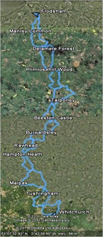
The Sandstone Trail walks (click to go to Google Maps)

These days we frequently hear stories of heroic acts of walking: to the Poles, across the Andes, up the Amazon, often undertaken at great speed or under conditions of considerable disability.

This little post is a record of our trek down the Sandstone Trail, 34 miles close to our home in Chester. Our route, drawn from “Circular walks along the Sandstone Trail” by Carl Rogers, adds up to a total of 77 miles. These distances are the sort of things that serious trekkers would cover in less than 24 hours, probably combined with a swim and a 100 miles cycle. Our effort was rather more leisurely – it took us about 14 months. Traditionally we walk on a Sunday morning, usually finishing before lunch.

The Sandstone Trail is covered in 13 walks:

  1. Frodsham
  2. Manley Common
  3. Delamere Forest
  4. Primrosehill Wood
  5. Tarporley
  6. Beeston Castle
  7. Peckforton
  8. Burwardsley
  9. Rawhead
  10. Hampton Heath
  11. Malpas
  12. Tushingham
  13. Whitchurch

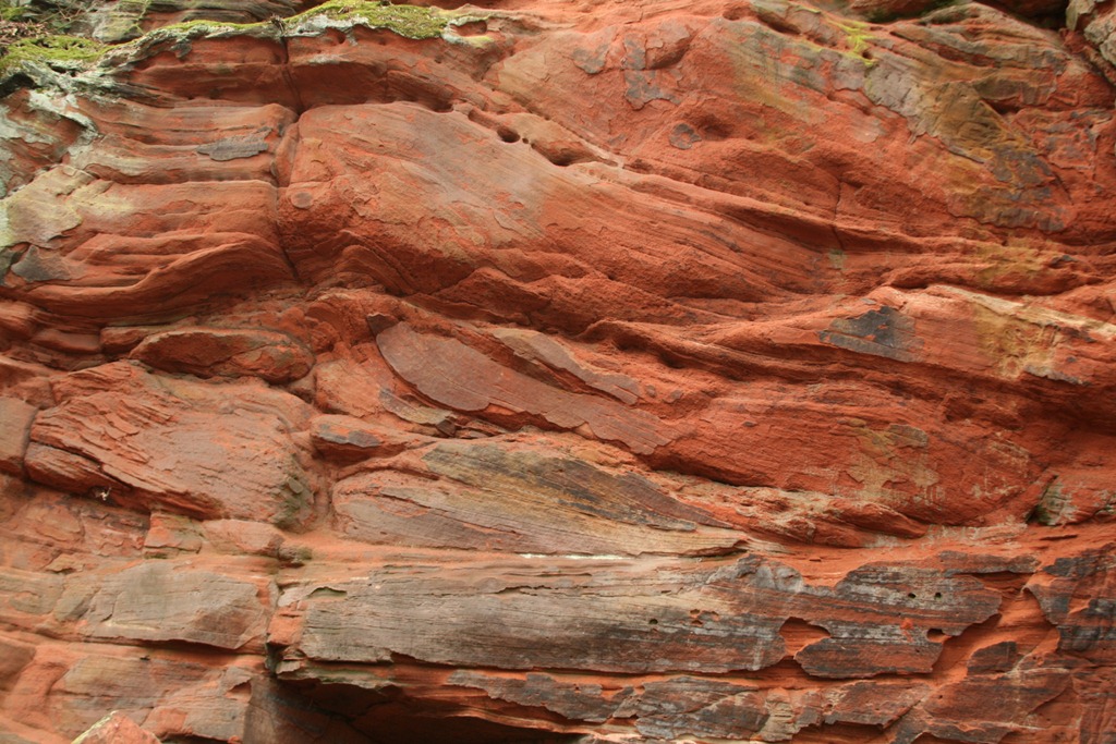
These range in length from 5 to 8 miles.  To start off, here is some of the eponymous sandstone, in this case from above Frodsham:

Sandstone

Sherwood Sandstone Group from above Frodsham

The sandstone is from the Sherwood Sandstone Group laid down in the Early Triassic, 250 million years ago.

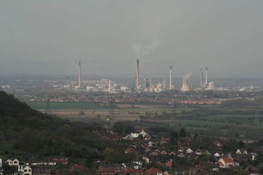
The small town of Frodsham lies close to the Mersey Estuary and after you have climbed up onto the sandstone heights above the town you get a fine view towards Liverpool and across the industrial works at Stanlow refinery and Runcorn. I’m rather fond of these, Runcorn is a fine collection of pipes, tubes and the odd ball shaped thing whilst the Stanlow refinery looks like something out of Bladerunner; at night they are lit up with gas flaring off on some of the chimneys.

IMG_5083

Stanlow Oil Refinery

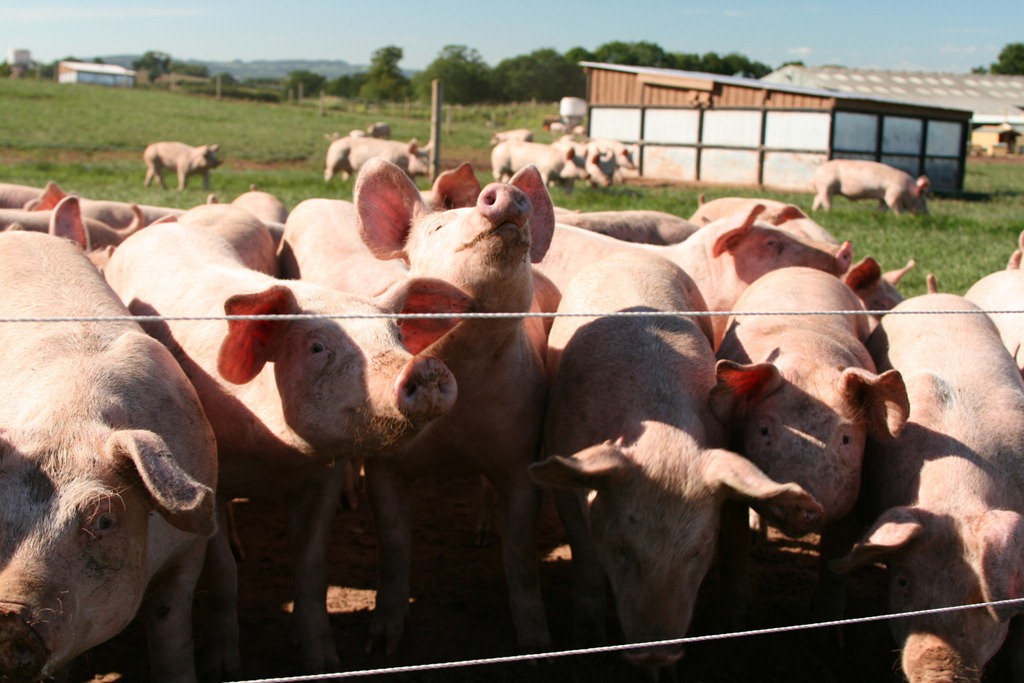
The walks to Primrosehill Wood are rather pleasant, at Manley Common we were inspected by enthusiastic pigs.

IMG_6920

Pigs!

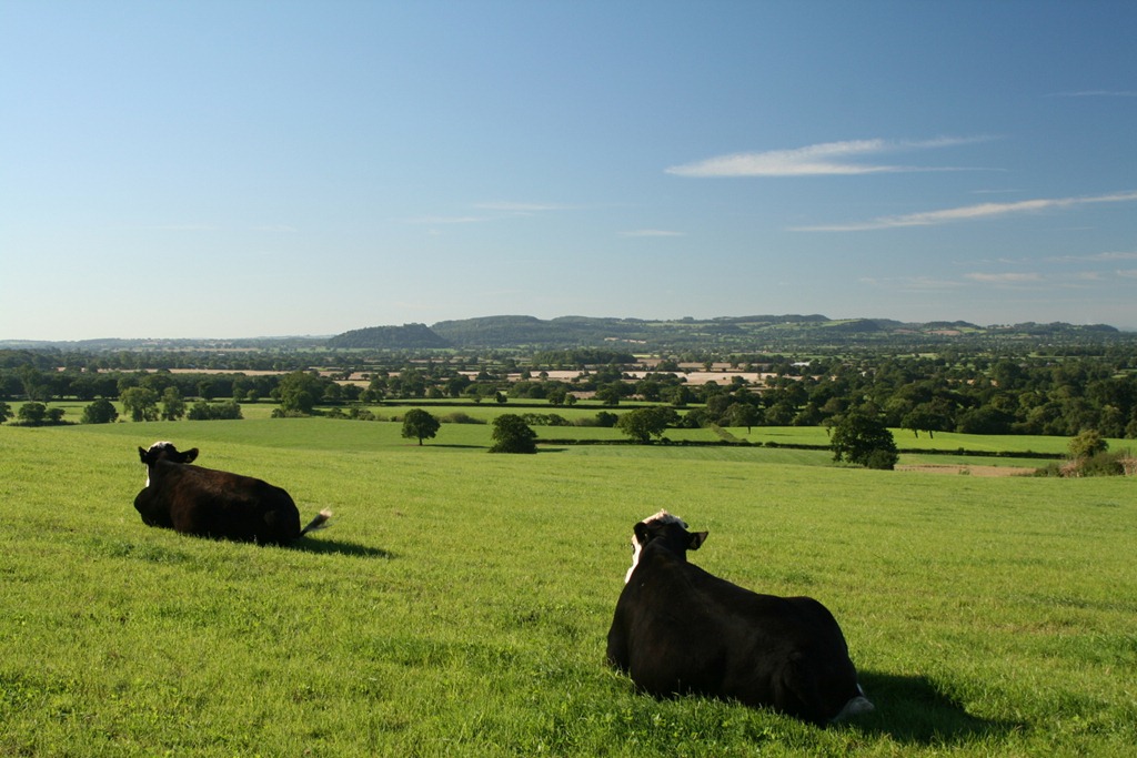
We also saw a lot of cows:

IMG_6900

Cows looking towards Beeston Castle

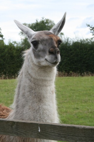
And a llama (rather further along the Trail):

Llama

LLama

The llama was very inquisitive, perhaps overly so since there was a small diversion around its field with a note highlighting that dogs and walkers with sticks had interacted with it rather more than was strictly desirable. As we walked past its field it followed us very closely over the fence with a look of what could have been either llamaly inquisitiveness or aggression.

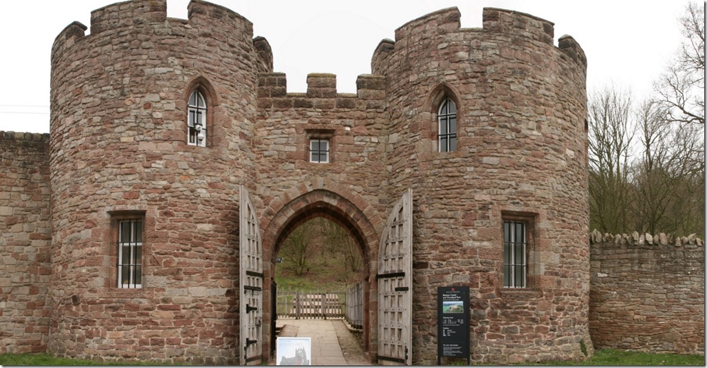
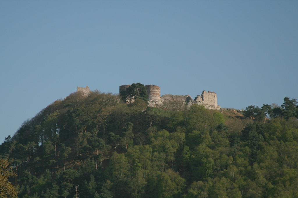
For me the Tarporley and Beeston Castle walks were a bit of a slog, they span the Cheshire Gap, a flat area of clay farmland. The Beeston Castle walk in particular comprises a trip out into the plain and then back again with the Castle the sole point of interest for the whole walk. The Castle is pretty impressive but you have to pay to get in, so we didn’t.

Beeston Castle Gateway

Beeston Castle Gateway

Beeston Castle

Beeston Castle

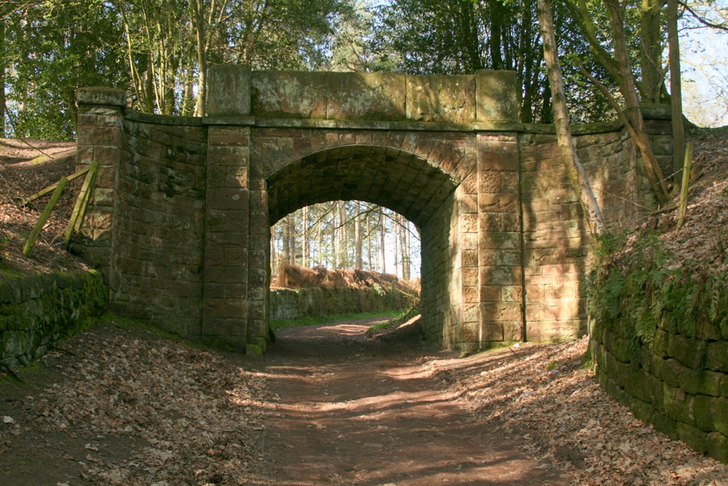
The next three walks, Peckforton, Burwardsley and Rawhead are my favourites, at this point the Sandstone Trail heads up onto a wooded ridge with lovely views in all directions. The Peckforton Estate has left some classy stonework along the route.

View from Bulkeley Hill Wood

View from Bulkeley Hill Wood

Haunted Bridge

Haunted Bridge on the Peckforton Estate

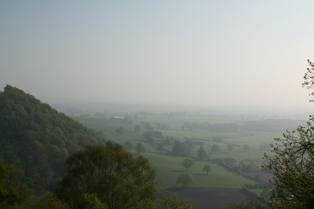
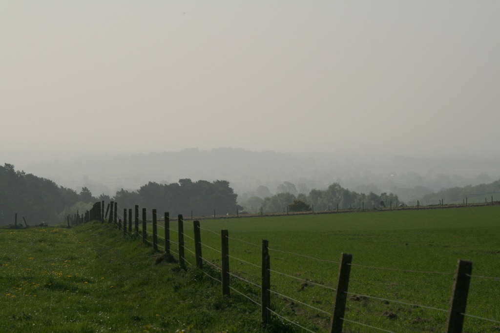
Misty view from near Rawhead

Misty view from near Rawhead

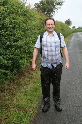
The last four walks: Hampton Heath, Malpas, Tushingham and Whitchurch take you off the  ridge for more walking across rolling farmland with a couple of stretches along the canal. We did manage to get very wet one day:

Ian

Me, wet

This was achieved by crossing a field of oil seed rape not long after heavy rain, I think this is the wettest I’ve ever been following a walk (and I’ve walked in the Lake District!). As you can see the crop reached a height of approximately five feet and held an awful lot of water.

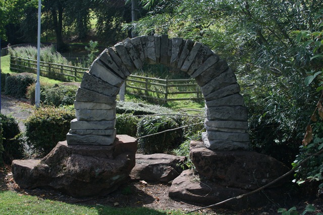
I must admit to not being too fond of this type of walking but we could not leave walks undone. This little arch, in Jubilee Park in Whitchurch, marks the end of the Sandstone Trail.

End of the Sandstone trail

End of the Sandstone trail

You can see the GPS tracks I captured on the walk here in Google Maps.

Caerwys – a breezy spring walk

Off to Afon-wen and Caerwys today for a brisk walk featuring steep walking through woods, spring flowers, llamas, highland cows and a newt. You can see the route here:


View Caerwys in a larger map

It’s a walk from “Walking in the Clwydian Range” by Carl Rogers, real men make up their own walks from OS maps and scouting missions but I’m lazy. A cool spring day today, in the distance we could still see the odd patch of snow on the hillsides. The trees were bare but the flowers had started to come out:

Clockwise from top left: Primrose, violet, wood anemone, and celandine
There were many birds out, singing away enthusiastically. I was going to show a picture of a woodpecker which we heard tapping away very close by, but we didn’t see it so it would really have been a conceptual piece so I’d like you take that conceptuality one step further and imagine a picture of a tree with an unseen woodpecker in it. Caerwys is the home of llamas, which I also treat with a degree of respect, since they spit if you offend them:

Although it’s a very rural location there are both signs of modern industrialisation in the from of quarries and sandpits and also the remnants of older work, including this lime kiln:

And also this rather creepy corrugated iron building which put me in mind of “Jeepers Creepers” or “Deliverance“:

With a vivid imagination, a walk in the countryside is never boring! We walked through the village of Caerwys, which is quite pretty – many of the houses seem to be well-made from the local limestone. No photos though, mainly because the streets were full of parked cars which are an aesthetic abomination and I don’t like photographing people’s houses in close up – it seems rude. However, I had no qualms about photographing this fine house across Ysceifiog Lake which was created for fishing by the Earl of Denbigh in 1904:

We next passed through a small nature reserve: Y Ddol Uchaf, which is a designated Site of Special Scientific Interest (SSSI) whose information board promised newts, and lo – I saw that there were newts and it was good:

On the final stretch back to the car we were treated to these handsome chickens:

And some Highland cows, we first sighted some of these in the distance across a field then we passed close by to another group behind a photography unfriendly fence then eventually coming to some easily accessible ones in photogenic mud:

This one, is the bull in the group, I’m a country lad and was easily able to identify him as such by dint of his sizeable testicles (which I refrained from photographing):

So there you go, a memorial of our Easter Sunday walk immortalised for when I am old and incapable of leaving the house.

A walk along the Shropshire Union Canal

Yesterday the weather was so evil, cold and wet, that we scarcely left the house all day – cabin fever set in. This morning things were looking rather better, cold and frosty, but a little hazy – so we set off for a walk along the Shropshire Union Canal which passes close by. In the summer I cycled along the canal for a week, on my way to work, and saw a couple of kingfishers. No kingfishers today, but we saw a heron, a fox leaping through undergrowth and heard the distant roar of a lion at Chester Zoo.

Some photos:

Bryn Alyn – an autumn walk

Off to Llanferres yesterday for an autumn walk through the woods, along the ridge and back again. You can see the route here:


View Bryn Alyn in a larger map

It’s a variant on a route in “Walking in the Clwydian Range” by Carl Rogers. A tiny domestic detail: whilst walking the Inelegant Gardener carries the guide book, preferring to navigate via prose and I carry the OS map – preferring maps. The track is from a Garmin GPS60, I don’t use it for navigation but to tag my photos with location information for which I’ve written a little program.

We last did this walk in May, but I committed a terrible faux pas: the battery on my camera went flat and for some reason I’d not brought a spare and had deliberately left behind my second camera and my phone (which also has a camera, which is really crap).

Beech trees were definitely the best for autumnal colours, although birch produces an attractive pointillist effect, sycamore seemed best for kicking through.

At the top of the initial climb there is a little bit of limestone pavement, this is most famously found above Malham Cove but it’s nice to find your own little patch.

Limestone pavement is formed when slightly acidic rain water dissolves the limestone producing deep fissures (grykes) between remaining blocks (clints). It looks like a fantastic place to break your ankle.

For reasons I can’t explain I like the stray bits of ironwork left over from old fencing, parts of the Lake District are particularly good for this.

And to top it all off, a cow wearing a ginger wig:

This was one of many cows in a field we passed through, they were fine looking beef cows in a wide range of colours. We also had a “That’s no cow, it’s a bull” moment but I was reassured by remembering vaguely someone saying that you’re okay in a field with a load of cows and a bull because the last thing on the bull’s mind is going to be you. If this isn’t actually true then I’d prefer to be left in ignorance, if you don’t mind.