
 The longitude and navigation at sea has been a recurring theme over the last year of my reading. Sextant by David Barrie may be the last in the series. It is subtitled “A Voyage Guided by the Stars and the Men Who Mapped the World’s Oceans”.
Barrie’s book is something of a travelogue, each chapter starts with an extract from his diary on crossing the Atlantic in a small yacht as a (late) teenager in the early seventies. Here he learnt something of celestial navigation. The chapters themselves are a mixture of those on navigational techniques and those on significant voyages. Included in the latter are voyages such of those of Cook and Flinders, Bligh, various French explorers including Bougainville and La Pérouse, Fitzroy’s expeditions in the Beagle and Shackleton’s expedition to the Antarctic. These are primarily voyages from the second half of the 18th century exploring the Pacific coasts.
Celestial navigation relies on being able to measure the location of various bodies such as the sun, moon, Pole star and other stars. Here “location” means the angle between the body and some other point such as the horizon. Such measurements can be used to determine latitude, and in rather more complex manner, longitude. Devices such as the back-staff and cross-staff were in use during the 16th century. During the latter half of the 17th century it became obvious that one method to determine the longitude would be to measure the location of the moon relative to the immobile background of stars, the so-called lunar distance method. To determine the longitude to the precision required by the Longitude Act of 1714 would require those measurements to be made to a high degree of accuracy.
Newton invented a quadrant device somewhat similar to the sextant in the late 17th century but the design was not published until his death in 1742, in the meantime Hadley and Thomas Godfrey made independent inventions. A quadrant is an eighth of a circle segment which allows measurements up to 90 degrees. A sextant subtends a sixth of a circle and allows measurements up to 120 degrees.
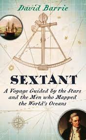
The sextant of the title was first made by John Bird in 1757, commissioned by a naval officer who had made the first tests on the lunar distance method for determining the longitude at sea using Tobias Meyer’s lunar distance tables.
Both quadrant and sextant are more sophisticated devices than their cross- and back-staff precursors. They comprise a graduated angular scale and optics to bring the target object and reference object together, and to prevent the user gazing at the sun with an unprotected eye. The design of the sextant changed little since its invention. As a scientist who has worked with optics they look like pieces of modern optical equipment in terms of their materials, finish and mechanisms.
Alongside the sextant the chronometer was the second essential piece of navigational equipment, used to provide the time at a reference location (such as Greenwich) to compare to local time to get the longitude. Chronometers took a while to become a reliable piece of equipment, at the end of Beagles 4 year voyage in 1830 only half of the 22 chronometers were still running well. Shackleton’s mission in 1914 suffered even more, with the final stretch of their voyage to South Georgia using the last working of 24 chronometers. Granted his ship, the Endeavour had been broken up by ice and they had escaped to Elephant Island in a small, open boat! Note the large numbers of chronometers taken on these voyages of exploration.
Barrie is of the more subtle persuasion in the interpretation of the history of the chronometer. John Harrison certainly played a huge part in this story but his chronometers were exquisite, expensive, unique devices*. Larcum Kendall’s K1 chronometer was taken by Cook on his 1769 voyage. Kendall was paid a total of £500 for this chronometer, made as a demonstration that Harrison’s work could be repeated. This cost should be compared to a sum of £2800 which the navy paid for the HMS Endeavour in which the voyage was made!
An amusing aside, when the Ordnance Survey located the Scilly Isles by triangulation in 1797 they discovered its location was 20 miles from that which had previously been assumed. Meaning that prior to their measurement the location of Tahiti was better known through the astronomical observations made by Cook’s mission.
The risks the 18th century explorers ran are pretty mind-boggling. Even if the expedition was not lost – such as that of La Pérouse – losing 25% of the crew was not exceptional. Its reminiscent of the Apollo moon missions, thankfully casualties were remarkably low, but the crews of the earlier missions had a pretty pragmatic view of the serious risks they were running.
This book is different from the others I have read on marine navigation, more relaxed and conversational but with more detail on the nitty-gritty of the process of marine navigation. Perhaps my next reading in this area will be the accounts of some of the French explorers of the late 18th century.
*In the parlance of modern server management Harrison’s chronometers were pets not cattle!
