Tag: History

Book review: A computer called LEO by Georgina Ferry

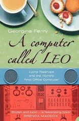
AComputerCalledLEOThis is a review of “A Computer called LEO” by Georgina Ferry, recounting the story of the first computer developed for business use by J. Lyons & Co, the teashop and catering company.

Lyons formed in 1884, a spin-off from a family tobacconist company whose traveling salesman realised that there were few reliable teashops around the country, furthermore catering at large events such as the Great Exhibition was poor. Over the next 30 years or so the business grew, with a chain of teashops, and smarter establishments such as the Corner Houses and Trocadero. The teashops were supplied by Lyons own manufacturing and delivery service.

By the 1930s Lyons had approximately 30,000 workers, as such it was one of Britain’s larger employers. 300 clerks were used to tot up daily takings on mechanical calculators. Clerical work had risen in important during the second half of the 19th century with numbers rising from 70,000 in Britain in 1851 to 2 million in 1901. The company had a department of Systems Research led by a Cambridge mathematician, John Simmons, who the company had recruited in 1923, the hiring of such a graduate was a novelty at the time. The Systems Research department was interested in the efficient running of the business.

By this time various items of office machinery were commonplace, things such as filing cabinets, typewriters, mechanical calculators, and punch card readers. Telephone exchanges were in place, the electronic valve had been invented in the early years of the 20th century and magnetic storage devices were starting to become available. By the 1930s people such Oliver Standingford in Lyon’s Stock Department were talking about machines which would combine these elements, although he was not clear on the detail of how this would be done.

The Second World War then intervened, Lyons cut table service from its teashops as labour went short. Various people gained useful experience in electrical engineering through the wartime developments in radar, and possibly codebreaking. We now know that Colossus, a computer used for code breaking, was built at Bletchley Park during the war but it did not become public knowledge until 1974. In the US ENIAC had been developed at the Moore School in Philadelphia to do artillery range calculations. This was not a secret and immediately after the war, Oliver Standingford and Raymond Thompson visited from Lyons; they had a broad brief to investigate American business methods but it was ENIAC which really captivated them. Fortunately, their US trip put them in touch with more local expertise in the form of Douglas Hartree at Cambridge University who was building a computer, EDSAC, for the Mathematical Laboratory.

Lyons decided fairly quickly to construct their own computer, which was to be based on the EDSAC machine; US machines such as they were could not be purchased because of currency restrictions and there were no computer manufacturers in the UK. From the start LEO I (the first computer) was different, Simmons saw the computer fitting into a system of “scientific management” and as such LEO was crafted to exactly fit the role he foresaw for it based on detailed knowledge of the company’s processes. In some senses computing for business was more demanding than the computation done in the Mathematical Laboratory and other scientific laboratories: business computing had large demands for input and output (imagine a payroll system – it needs to read in details of each employee and print out the results), it had lower tolerance for failure (payroll failing to run has a serious impact on employees) and calculations could be more “complex” than mathematical ones in the sense that more steps in calculation and more conditionality was required. It was at Lyons that the art of flowcharting was developed. The first live duty that LEO carried out was in 1951, it was made public in 1955. It’s interesting to note that Charles Babbage had highlighted the potential for automation in both manufacturing and mathematical operations in his book “On the Economy of Machinery and Manufacturers”, published in 1832.

There were to be two further LEO computers, developed by a separate company, Leo Computers Ltd however things did not go well. The computers themselves were technically advanced, and the Leo Computers method of going into a business and closely examining their processes before writing programs and delivering a system combining both hardware and software usually had excellent results. However, this had the unfortunate side-effect of losing their best staff to their clients. Other problems were afoot: Leo Computers Ltd although nominally a separate company was under-resourced both financially and in personnel with development engineers also acting as salesman. The parent company, Lyons was struggling – victim of a family business mentality which put increasingly useless family members at the heads of divisions.

In 1964 Leo Computers Ltd was merged with English Electric, with Lyons divesting itself of any responsibility, following this union the LEO line died although the final computers in the series were installed by the Post Office, and continued to run there, in places, until 1981.

In contrast in the 1960s IBM were able to make an investment of $5billion on their System 360 computers – a compatible range designed to fit every need. They had a ready market in the US both of businesses willing to buy, unlike their British counterparts, and a government who bought locally first. Faced with this opposition, the British computer industry struggled to compete.

Focusing on the LEO computer makes this a human scale story with central cast of characters, but it also provides a wider view of the field in the years after the Second World War. The book makes clear how J. Lyons & Co had a system of management, and personnel in place which were ripe for computerisation; the developments in the 1930s made it clear that electronic computers were in the air. Large scale failures of computer systems in both public and private sectors are onging, John Simmons was rather insightful in his intimate coupling between business process and software system.

References

1. My Evernotes are here

2. The web page of the Leo Computer Society is http://www.leo-computers.org.uk/

Book review: Measure of the Earth by Larrie D. Ferreiro

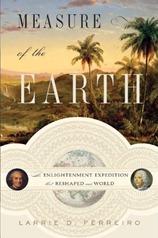
Measure-of-the-EarthThis post is a review and summary of Larrie D. Ferreiro’s book “Measure of the Earth” which describes the French Geodesic Mission to South America to measure the length of a degree of latitude at the equator. The action takes place in the 2nd quarter of the 18th century, the Mission left France in 1735 with the first of its members returning to Europe in 1744.

The book fits together with The Measure of All Things by Ken Alder, which is about the later French effort to measure a meridian through Paris at the turn of the Revolution in order to define the metre, The Great Arc by John Keay on the survey of India and Map of a Nation by Rachel Hewitt on the triangulation survey of the United Kingdom.

The significance of the measurement was that earlier triangulation surveys of France had indicated that the earth was not spherical, as had pendulum measurements made by Jean Richer in Guyana in 1671 which showed a pendulum there ran 2:28 slower there than in Paris. A Newtonian faction believed that the earth was flattened at the poles, its rotation having led to a bulging at the equator. A Cartesian school held that the earth was flattened around the equator and bulged at the poles, this was not a direct result of work by Rene Descartes but seems to have been more a result of scientific nationalism. Spoiler: the earth is flattened at the poles.

From a practical point of view a non-spherical earth has implications for navigation – ultimately it was found that polar flattening would lead to a navigational error of approximately 20 miles in a trans-Atlantic crossing although at the time of the Mission it was believed it could have been as much as 300 miles. Politically the Mission provided an opportunity for the French to form an alliance with the Spanish, and to get a close look at the Spanish colonies in South America which had provided huge wealth to Spain over the preceding 200 years. Ferreiro provides a nice overview of the L’Académie des Sciences under whose aegis the mission was conducted,and of the Comte de Maurepas, French minister of the navy and sponsor of the Mission.

The core members of the Geodesic Mission were Pierre Bouguer, Charles-Marie de La Condamine, and Louis Godin they were accompanied by Spanish Naval cadets Antonio de Ulloa y de la Torre-Guiral  and Jorge Juan y Santacilia. Other members were Joseph de Jussieu (doctor and botanist), Jean-Joseph Verguin (engineer and cartographer), Jean-Louis de Morainville (draftsman and artist), Theodore Hugo (instrument maker), Jean-Baptiste Godin des Odonais and Jacques Couplet-Viguier.

Louis Godin, an astronomer, was the senior academician and nominal leader of the mission. Pierre Bouguer, was a mathematician, astronomer and latterly geophysicist: as well as the measurement of the degree of latitude he also attempted to measure the deflection of a plumb-line by the mass of a mountain – an experiment which Nevile Maskelyne was to conclude successfully in 1775, I wrote about this here. Bouguer also wrote a treatise on ship building whilst away in South America. Charles-Marie de La Condamine could best be described as an adventurer although he was also a competent mathematician and geographer, it was his more lively writing on life in South America which would have a bigger impact on their return to Europe.

The scheme for the determination of the length of a degree is to measure the length of a meridian (a line of longitude) close to the equator by triangulation, making a ground measurement baseline to convert the angular measurements of the triangulation survey into distances and a second baseline to confirm your workings; the latitudes of the ends of the triangulation survey are determined astronomically by measuring the positions of stars. I’ve read of this process before, the new thing I learnt was the method for aligning up your zenith sector with the meridian – which I’m tempted to try at home.

These measurements were done in the area around Quito, in modern Ecuador (named after the equator), the endpoints of the survey were at Quito in the north, close to the equator and Cuenca approximately 200 miles south. During the survey, through the Andes, the team scaled peaks as high as Mont Blanc (and suffered altitude sickness for their troubles) which would not be climbed for another 50 years. The survey was repeated in the early years of the 20th century and even then it took 7 years – the same length of time as the original survey, due to the transport difficulties presented by the terrain.

The work of measuring the meridian was made more difficult by the journey to get there (which took the best part of a year), the terrain and conditions when they got there (mountainous and cloudy), the poor leadership of Godin, local political machinations and the mother country cutting them loose financially. Ferreiro makes a lot of Godin’s poor leadership, some of which is justified – he spent Mission money on prostitutes and regarded the Mission funds as his own purse. Frequently the Mission split into two groups, one containing Bouguer and La Condamine and the other Godin – sometimes this is quite appropriate, in duplicating measurements for consistency whilst on other occasions it is simply fractiousness.

To a degree the Mission was scooped by measurements made above the Arctic Circle in Lapland, this mission was also promoted by the L’Académie des Sciences, led by Pierre Maupertuis (a rival of Bouguer) and Anders Celsius. It completed its work in 6 months, well before the Geodesic Mission had finished their work, discovering that the poles of the earth were flattened. However, doubts remained over the results and the full determination required the data from the equator. Bouguer presented this on his return to France, to great acclaim, showing that the earth was flattened by 1 part in 179 (later measurements showed that the flattening is actually smaller at 1 part in 298).

The Mission spawned a wide range of publications by its members, covering not only the geodesic component of the work but also regarding life and nature in South America. Ferreiro credits La Condamine’s work in particular has setting the context of how South America was viewed for quite some time after the mission. The Spanish officers also made in impact an highlighting colonial misrule back to their home country. Arguably the international collaborative elements of the Mission set the scene for the measurements of the transit of Venus later in the 18th century.

Ferreiro makes a comparison between the French Geodesic Mission, which was centrally run by the state and the British Longitude Prize, which although state funded was privately executed, implying that the former was superior. It’s not clear to me whether he’s engaging in a degree of hyperbole here, since the Mission was to some degree an organisational car-crash and was in large part funded from La Condamine’s own purse at the time. Furthermore, L’Académie des Sciences also awarded prizes – having copied the British government in this and the Royal Society was from the outset a very internationally oriented organisation. So the picture as Ferreiro presents it is something of an over-simplification.

I found the book very readable, its clearly based on a large quantity of primary source material and covers a great deal beyond the simple mechanics of the Geodesic measurements.

Footnotes

My Evernotes on the book are here.

Book Review: Stargazers by Fred Watson

41W3OswkqxL._SS500_This post is a review of “Stargazers:The Life and Times of the Telescope” by Fred Watson. It traces the history, and development of the telescope from a little before its invention in 1608 to the present day.

The book begins its historical path with Tycho Brahe, a Danish astronomer who lived 1546-1601. He built an observatory, Uraniborg, on the Danish island of Hven in view of his patron, King Frederick II of Denmark. Brahe’s contribution to astronomy were the data which were to lead to Johannes Kepler’s laws of planetary motion and ultimately Isaac Newton’s laws of gravitation. On the technical side his observatory represented the best astronomy of pre-telescope days with the use of viewing sights, his Great Armillary with it axis aligned with that of the earth and graduated scales to measure angles. Watson also cites him as a first instance of a research director running a research institute – alongside the observatory he ran a print works to disseminate his results.

The telescope was first recorded in September of 1608, when Hans Lipperhey presented one to Prince Maurice of Nassau in the Netherlands. Clearly it was a device of its time since in very short order several independent inventions appeared, Galileo constructed his own version which led to his publication of “The Starry Messenger” in 1610 which reports his observations using the device. The telescope grew out of the work of spectacle makers; there are some hints of the existence of telescope-like devices in the latter half of the 16th century but these are vague and unsubstantiated. Roger Bacon and Robert Grosseteste both conceived of a telescope-like device in the 13th century, around the time the first spectacles were appearing. Although there are a few lenses from antiquity there is no good evidence that they had been used in telescopes.

The stimulus for the creation of the first telescopes seems to have been a combination of high quality glass becoming available, and skilled lens grinders. The lens making requirements for telescopes are much more taxing than for spectacles. The technology required is not that advanced, if you look around the web you’ll find a community of amateur astronomers grinding their own lenses and mirrors now using fairly simple equipment, typically a turntable with a secondary wheel which produces linear motion for the polishing head back and forward across the turning lens blank. The most technologically advanced bit is probably captured in the first step: “acquire your glass blank”.

Through the 17th century refracting telescopes were built of ever greater length in an effort to defeat chromatic aberration which arises from the differential refraction of light as a function of wavelength (colour) – long focal length lenses suffered from less chromatic aberration than the shorter focal length ones which would allow a shorter telescope. Johannes Hevelius made telescopes of 46m focal length (physically the telescope would be a little shorter than this), mounted on a 27m mast; Christiaan Huygens dispensed with the “tube” of the telescope entirely and made “aerial telescopes” with even longer focal lengths, up to 64m.

It was known through the work of Alhazen in the 10-11th century, and others, that reflecting, curved-mirrors could be used in place of lenses. A telescope constructed with such mirrors would avoid the problem of chromatic aberration. However, the polishing tolerances for a reflecting telescope are four times higher than that of a lens. Newton built the first model reflecting telescope in 1668 but no-one was to repeat the feat until John Hadley in 1721.

Theoretical understanding of telescopes developed rapidly in the 17th century both for refracting and reflecting telescopes, indeed for reflecting telescopes there were no fundamental advices in the theory between 1672 and 1905. The problem was in successfully implementing theoretical proposals. Newton claimed that chromatic aberration could not be resolved in a refracting telescope, however he was proved wrong by Chester Hall Moor in 1729, and somewhat controversially by John Dollond in 1758 who was able to obtain a patent despite this earlier work (which was defended aggressively by his son) – the trick is to build compound lenses comprised of glass of different optical properties.

Also during the 18th century the construction of reflecting telescopes became more common, William Herschel started building his own reflecting telescopes in 1773 with the aid of Robert Smith’s “Compleat system of opticks”. Ultimately he was to build a 40ft (12m) telescope with a 48 inch (1.2m) mirror in 1789, supported by a grant from George III. During his lifetime Herschel was to discover the planet Uranus (nearly called George in honour of his patron), numerous comets and nebulae. At the time “official” astronomy was more interested in the precise measurement of the positions of stars for the purpose of navigation. Herschel was to be followed by Lord Rosse with his 1.8m diameter mirror telescope built in 1845 at Birr Castle, this has been recently restored (see here). He too was interested in nebula and discovered spiral galaxies.

During the 19th century there were substantial improvements in the telescope mounts, with engineers gaining either an amateur or professional interest (men such as James Nasmyth and Thomas Grubb). Towards the end of the century photography became important, which placed more exacting standards for telescope mounts because to gain maximum benefit from photography it was necessary to accurately track stars as they moved across the sky to enable long exposure times. This is also the century in which stellar spectrography became possible with William Huggins publishing the spectra of 50 stars in 1864. Léon Foucault invented the metal coated glass mirror in 1857 which were lighter and more reflective than the metal mirrors used to that point. As the century ended the largest feasible refracting telescopes with lens diameters of 1m were just around the corner, above this size a lens distorts under its own weight reducing the image quality.

In 1930 Bernhard Schmidt designed a reflecting telescope which avoided the problem of aberrations away from the centre of the field of view making large field of view “survey” telescopes practicable. As a youth in the 1970s I learnt of the 200-inch (5 metre) Hale telescope at Mount Palomar, since then space telescopes able to see in the infra-red and ultra-violet as well as the visible have escaped the distortion the atmosphere brings; adaptive optics are used to counteract atmospheric distortion for earthbound telescopes and there are “distributed” interferometric telescopes which combine signals from several telescopes to create a virtual one of unfeasible size.

Watson mentions briefly radio telescopes and in the final chapters speculates on developments for the future and gravitational lensing – natures own telescopes built from galaxies and spread over light years.

I enjoyed “Stargazers” as a readable account of the history of the telescope which left me with a clear understanding of its principles of operation and the technological developments that enabled its use, it also provides a good jumping off point for further study.

Footnotes

My Evernotes for the book are here, featuring more detailed but slightly cryptic notes and links to related work.

Board of Longitude

It’s been a while since I did a data driven blog post, so here I am with one on the “Board of Longitude”. The board was established by act of parliament in 1714 with a headline prize of £20,000 to anyone who discovered a method to determine the longitude at sea to within 30 nautical miles. The members of the Board also had discretion to make smaller awards of up to £2,000 in support of proposals which they thought had merit. The Board was finally wound up in 1828, 114 years after its formation.

The latitude is your location in the North-South direction between the equator and either of the earth’s poles, it is easily determined by the position of the sun or stars above the horizon, and we shall speak no more of it here.

The longitude is the second piece of information required to specify ones position on the surface of the earth and is a measure your location East-West relative to the Greenwich meridian. The earth turns at a fixed rate and as it does the sun appears to move through the sky. You can use this behaviour to fix a local noon time: the time at which the sun reaches the highest point in the sky. If, when you measure your local noon, you can also determine what time it is at some reference point Greenwich, for example, then you can find your longitude from the difference between the two times.

The threshold for the highest Longitude award amounts to knowing the time at Greenwich to within 2 minutes, wherever you are in the world, and however you got there. This was a serious restriction at the time, because a journey to anywhere in the world could have taken months of voyaging at sea with its concomitant vibrations and extremes of temperature, pressure and humidity all of which have serious implications for precision timekeeping devices.

The Board of Longitude intertwines with various of the people whose biographies I’ve read, and surveying efforts taking place during the 18th and 19th centuries. It made a walk on appearance in Tim Harford’s Adapt, which I’ve just read, as an early example of prizes being offered to solve scientific problems.

Below I present data on the awards made by the Board during its existence from 1714 to 1828. The data I have used is from “Britain’s Board of Longitude: The Finances, 1714-1828” By Derek Howse1 which I reached via The Board of Longitude Project based at the Royal Museums at Greenwich. The chart below shows the cumulative total of the awards made by the Board (blue diamonds), awards made to John Harrison who won the central prize of the original Board (black triangles) and the dates of Acts of Parliament relating to the Board (red squares). Values are presented as at the time they were awarded, the modern equivalent values are debatable but the original £20,000 award is said to have been worth between £1million and £3.5million in modern terms, so a rule of thumb would be to multiple by 100 to get approximate modern values.

image

Although established in 1714, the Board made no reward until 1737 and until 1765 made the great majority of awards to John Harrison for his work on clocks; clockmakers Thomas Earnshaw (1800, 1805), Thomas Mudge (1777,1793) and John Arnold (father and son 1771-1805) also received significant sums from the Board.

A second area of awards was in the “lunar” method of determining the longitude which uses the positions of stars relative to the moon to determine time and hence longitude. The widow of Tobias Mayer received the largest award, £3,000, for work in this area. The list of awardees contains a number of famous European mathematicians including Leonhard Euler, Friedrich Bessel, and Johann Bernoulli.

After 1763 the Board started to branch out, having been mandated by parliament to prepare and print almanacs containing astronomical information. In the twilight of its years the Board gained responsibility for awards relating to the discovery of the North-West passage (a sea route from the Atlantic to the Pacific via the north of Canada), the second largest recipient of awards for the whole period were the crews of the Hecla and Griper of £5000 in 1820 for reaching 110oW within the Arctic Circle, pursuing this goal.

The story of the Board of Longitude is often presented as a battle between the Board and John Harrison for the “big prize” but these data highlight a longer and more subtle existence with Harrison receiving support over an extended period and the Board going on to undertake a range of other activities.

References

1. “Britain’s Board of Longitude: The Finances, 1714-1828” By Derek Howse, The Mariner’s Mirror, Vol. 84(4), November 1998, 400-417. (pdf) Sadly the article notes that Derek Howse died after the preparation of this article.

2. Data from (1) can be found in this Google Docs spreadsheet

Book Review: The Great Arc by John Keay

TheGreatArcThis is a review of “The Great Arc: The Dramatic Tale of How India Was Mapped and Everest Was Named” by John Keay. This book does exactly what it says in the lengthy subtitle: describe the Great Triangulation Survey of India which was conducted in the first half of the 19th century.

It fits together with “Map of a Nation” by Rachel Hewitt and “The Measure of All Things” By Ken Alder. The former describes the detailed mapping of the United Kingdom by the Ordnance Survey, whilst the later describes the measurement of the Paris meridian by Méchain and Delambre. Of the three surveys the French one had been completed first at the beginning of the 19th century whilst the mapping of the UK was going on at the same time as the Indian survey.

The book is centred around the Great Arc survey originally proposed by William Lambton at the beginning of the 19th Century. Lambton’s aim was primarily to measure a meridian (a line of longitude), in the same manner as the Paris meridian in order to gain more information on the shape of the earth (geodesy). For his sponsors in England and the administration of India the survey served as a military and commercial exercise. Military action is often a spur to survey, since getting your troops and their equipment from point A to point B and ensuring they prevail over any forces they come across on the way is a high-value activity which is greatly assisted by the provision of accurate maps. Surveying is also invaluable when you are planning infrastructure such as roads, canals and railways.

The survey came a time when the British relationship with the area now known as India was changing from a trading one based on outposts to one in which the British took territory militarily. The Triangulation Survey was not exhaustive, it comprised a central spine (The Great Arc) running along the 78th meridian up through the tip of the Indian peninsular to the edge of the Himalayas with regular “cross-bars” running from West to East, towards the north an array of parallel meridians were also measure. (You can see a map here). The aim was to use this survey to constrain further local surveys.

The Great Arc survey was a great endeavour, taking 40 or so years in total, after Lambton died in 1823 George Everest took on the job of leading the project. Lambton seems to have been a pleasant sort of chap who went a little native, disappearing from the view of his sponsors. Everest, on the other hand, appeared to be a complete git – being abusive to most of his subordinates and apparently also winding up his superiors.

Much of the activity in the book is in common with that which took place during the surveys of France and the United Kingdom. Laying out base-lines: distances measured directly on the ground by means of rods or chains used to pin down the distances in the “triangulation” which is a collection of angular measurements at the vertices of an array of triangles. Once again the precision is impressive, two 7 mile baselines measured out 200 miles apart agree with the triangulation measurement to within a few inches. Angular measurements were made using a theodolite, Keay labels the one used in India as the “Great Theodolite”, which I thought was a term reserved for the Ramsden device used in the UK (we can’t all have a Great Theodolite!).

The Indian survey presented different challenges in the form of the wildlife (tigers, scorpions etc) but also disease. The rate of attrition amongst the surveyors, particularly as they traversed jungle was terrible. The book is not explicit about figures but in the later stages of the survey something like a thousand men were involved and a couple of hundred of those died of disease. Lambton and later Everest both suffered from recurring bouts of malaria.

The “discovery” of Mount Everest and the tallest peaks in the Himalayas was somewhat incidental to the main thrust of the survey. It had become clear in the first decade or so of the 19th century that the Himalayas were the tallest mountains in the world but their precise height was uncertain. Political difficulties with Nepal, their location far from the sea and their immense size meant determinations were poor. Indeed at the time of the beginning of the survey the height of Mont Blanc in Europe was only know to within a thousand feet or so of its currently accepted value. It wasn’t until 1856, after the Great Arc had been completed and Andrew Scott Waugh had taken over the survey that Mount Everest (known at the time as Peak XV) was measured and Waugh proposed Everest be its name. (Everest is apparently pronounced Eve-rest rather than Ever-est, and the man himself was very particular about this).

Put beside “Map of a Nation” and “The Measure of All Things”, “The Great Arc” is a nice, brief introduction to the theme of triangulation surveys and geodesy which covers measuring the height of mountains in a bit more detail than the other two.

The Great Arc survey, along with the French meridian survey fit together with the earlier French Geodesic Mission to Peru by Condamine and Bouger around 1735, which is described in “Measure of the Earth” by Larrie G. Ferreiro – I’ve added this to my wish list.

Footnotes

You can see my Evernotes on The Great Arc here.